- Badallan pit
- Badallan No.2 mine
- Balbardie - old pits
- Balbardie No.1 pit
- Balbardie No.2 pit
- Balbardie No.2 mine
- Balbardie No.4 pit
- Balbardie No.5 pit
- Ballencreiff fireclay mine
- Ballencrieff - early pits
- Barbauchlaw - early pits
- Barbauchlaw No.1 pit
- Barbauchlaw No.2 pit
- Barbauchlaw No.3 pit
- Barbauchlaw No.4 pit
- Barbauchlaw No.5 pit
- Barbauchlaw No.7 pit
- Barbauchlaw No.9 pit
- Barbauchlaw No.11 pit
- Barbauchlaw No.10 pit
- Barbauchlaw No.12 pit
- Barbauchlaw No.13 pit
- Barbauchlaw No.14 pit
- Barbauchlaw No.15 pit
- Barbauchlaw No.16 pit
- Barbauchlaw No.17 pit
- Barbauchlaw No.18 pit
- Barbauchlaw No.19 pit
- Barbauchlaw No.23 pit
- Barbauchlaw Fireclay and Coal Mine
- Bathgate - old pits
- Bathville No.1 pit
- Bathville No.3 pit
- Bathville No.4 pit
- Bathville No.5 pit
- Bathville unidentified pit 1
- Bathville unidentified pit 2
- Bathville unidentified pit 3
- Benhar (Addie) No.2 pit
- Benhar No.6 and No.14 pits
- Benhar Colliery
- Benhar No.18 pit
- Benhar No.19 pit
- Benhar No.21 pit
- Benhar No.3 pit
- Benhar No.5 pit
- Benhar - old pits
- Benhar unidentified pits
- Benthead No.1 mine
- Benthead unidentified pit 1
- Benthead unidentified pit 2
- Benthead unidentified pit 3
- Benthead unidentified pit 4
- Benthead unidentified pit 5
- Benthead unidentified pit 6
- Bents mine
- Birniehill mine
- Blackrigg No. 1 & 2
- Blackrigg No.3 pit
- Boghead No.1 pit
- Boghead No.2 pit
- Boghead No.3 pit
- Boghead No.4 pit
- Boghead No.5 pit
- Boghead No.6 pit
- Boghead No.8 pit
- Boghead No.9 pit
- Boghead No.10 pit
- Boghead No.11 pit
- Boghead No.12 pit
- Boghead No.14 pit
- Boghead No.15 pit
- Boghead No.25 mine
- Braehead No. 1 pit
- Braehead No.2 pit
- Bridgecastle - early pits
- Bridgehouse - old pits
- Bridgehouse pit
- Brucefield pit
- Camps pit
- Cappers No.1 pit
- Cappers No.2 pit
- Cappers No.3 pit
- Cappers No.4 pit ?
- Colinshiel No.1 pit
- Colinshiel No.2 pit
- Colinshiel No.3 pit
- Colinshiel No.4 pit
- Cowdenhill No.1 Pit
- Craigrigg pit
- Crofthead (Stonehead) No.1 pit
- Crofthead No.2 pit
- Crofthead No.3 pit
- Crofthead No.5 & 6 pit
- Crofthead No.7 pit
- Crofthead (Stonehead) No.7 pit
- Cult pit
- Cultrigg No.1 & No.2 pits
- Cultrigg No.3 pit
- Cultrigg No.4 pit
- Cuthill mines
- Drumcross pits
- Drum No.1 & 2 pits
- Dumback No.1 mine
- Dumback No.2 mine
- East Benhar No.2 mine
- Eastfield No.1 ironstone pit
- Eastfield No.3 ironstone pit
- Eastfield No.3 coal pit
- Eastfield No.4 ironstone pit
- Eastfield No.5 pit
- Eastfield No.6 pit
- Eastfield No.8 ironstone pit
- Eastfield Eagin pit
- Eastfield Engine pit
- Eastfield unidentified pit 1
- East Handaxwood fireclay mine
- Easton No.1 pit
- Eastrigg (Craigrigg) No.1 pit
- Eastrigg (Craigrigg) No.2 pit
- Eastrigg (Craigrigg) No.3 pit
- Fallahill No.3 pit
- Fallahill No.4 pit
- Fauldhouse No.1 pit
- Fauldhouse No.1 (Knowes) pit
- Fauldhouse No.5 pit
- Fauldhouse No.8 pit
- Fauldhouse No.9 pit
- Fauldhouse No.10 pit
- Fauldhouse No.11 pit
- Fauldhouse No.13 pit
- Foulshiels No.1 & No.2 pits
- Gormyre mine
- Goukstane pit
- Greenburn pit
- Greenrigg pit
- Handaxwood No.1 pit
- Handaxwood No.2 pit
- Handaxwood No.3 pit
- Handaxwood No.4 pit
- Handaxwood No.5 pit
- Handaxwood early pits
- Handaxwood unidentified pit 1
- Handaxwood unidentified pit 2
- Handaxwood unidentified pit 3
- Handaxwood unidentified pit 4
- Handaxwood unidentified pit 5
- Handaxwood unidentified pit 6
- Handaxwood unidentified pit 7
- Handaxwood unidentified pit 8
- Handaxwood unidentified pit 12
- Handaxwood unidentified pit 13
- Handaxwood unidentified pit 14
- Handaxwood unidentified pit 15
- Harburn limestone mine
- Harthill No.1 ironstone pit
- Hartrigg or Harthill No.3
- Hartrigg No. 4 & 5 pit
- Heads mine
- Heatherfield No.4 pit
- Heatherfield No.5 pit
- Heatherfield No.6 pit
- Heatherfield No.7 pit
- Hilderston Hill pit
- Hilderston - early pits
- Hopetoun No.2 pit
- Heatherfield No.3 pit
- Hopetoun No.8 pit
- Hopetoun No.9 pit
- Hopetoun No.10 pit
- Hopetoun No.11 pit
- Hopetoun No.12 & 13 pits
- Inchcross No.1 pit
- Inchcross No.2 pit
- Kipps - early pits
- Knowton No.1 & 2 pits
- Latchburn pit
- Leadloch No.1 pit
- Leadloch No.2 pit
- Levenseat No.1 limestone pit
- Levenseat No.2 pit
- Levenseat No.3 limestone pit
- Levenseat No.3 fireclay mine
- Levenseat No.4 fireclay mine
- Levenseat No.1 & 2 fireclay mine
- Levenseat High mine
- Levenseat No.1 limestone mine
- Levenseat quarry limestone mines
- Levenseat unidentified mine
- Loganlea No.1 pit
- Loganlea No.2 pit
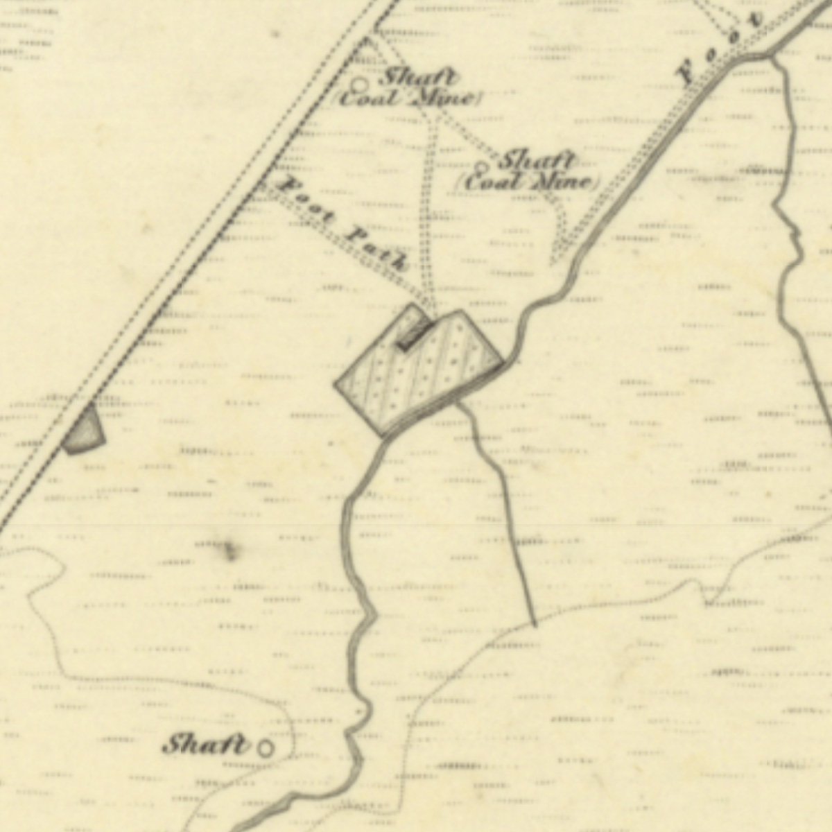
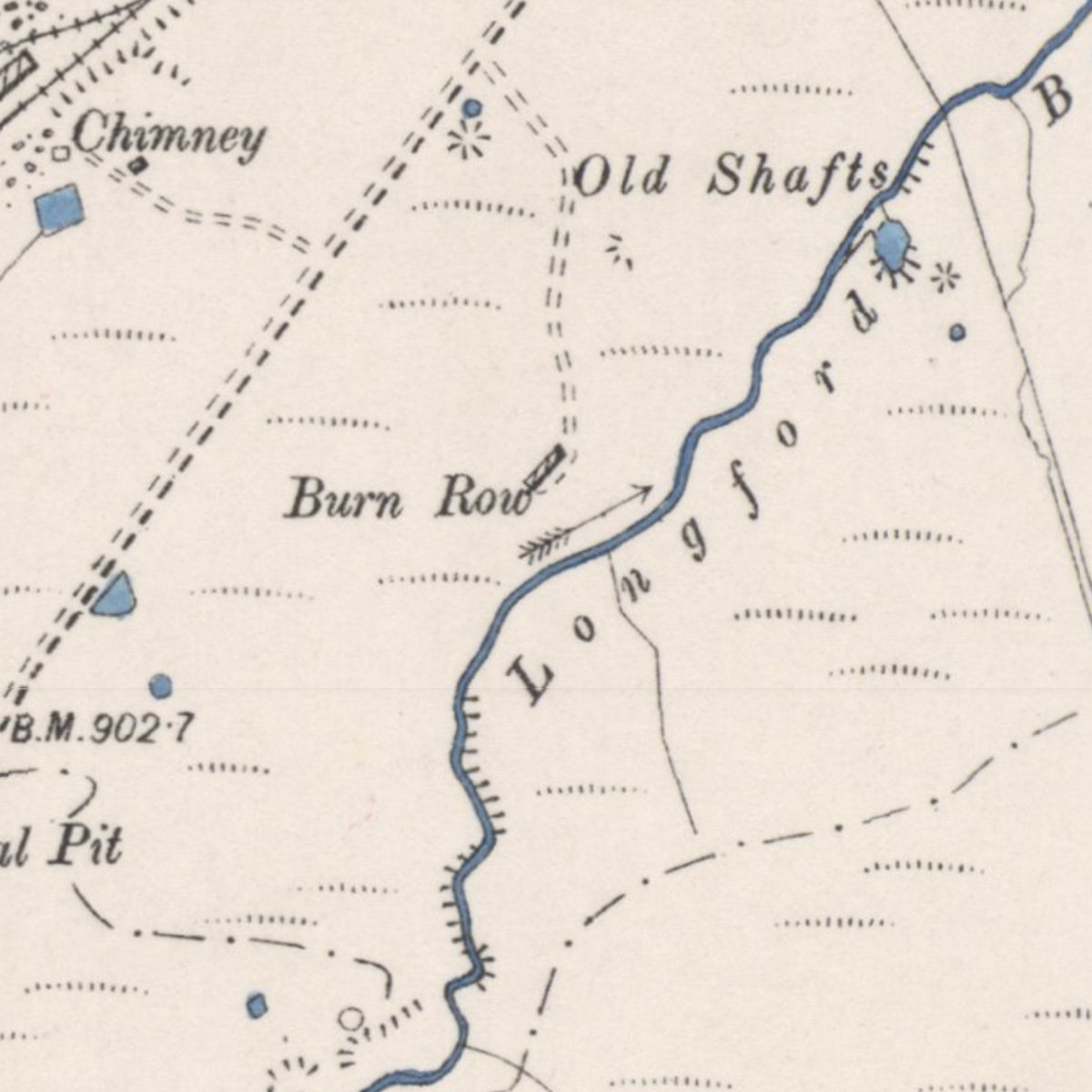
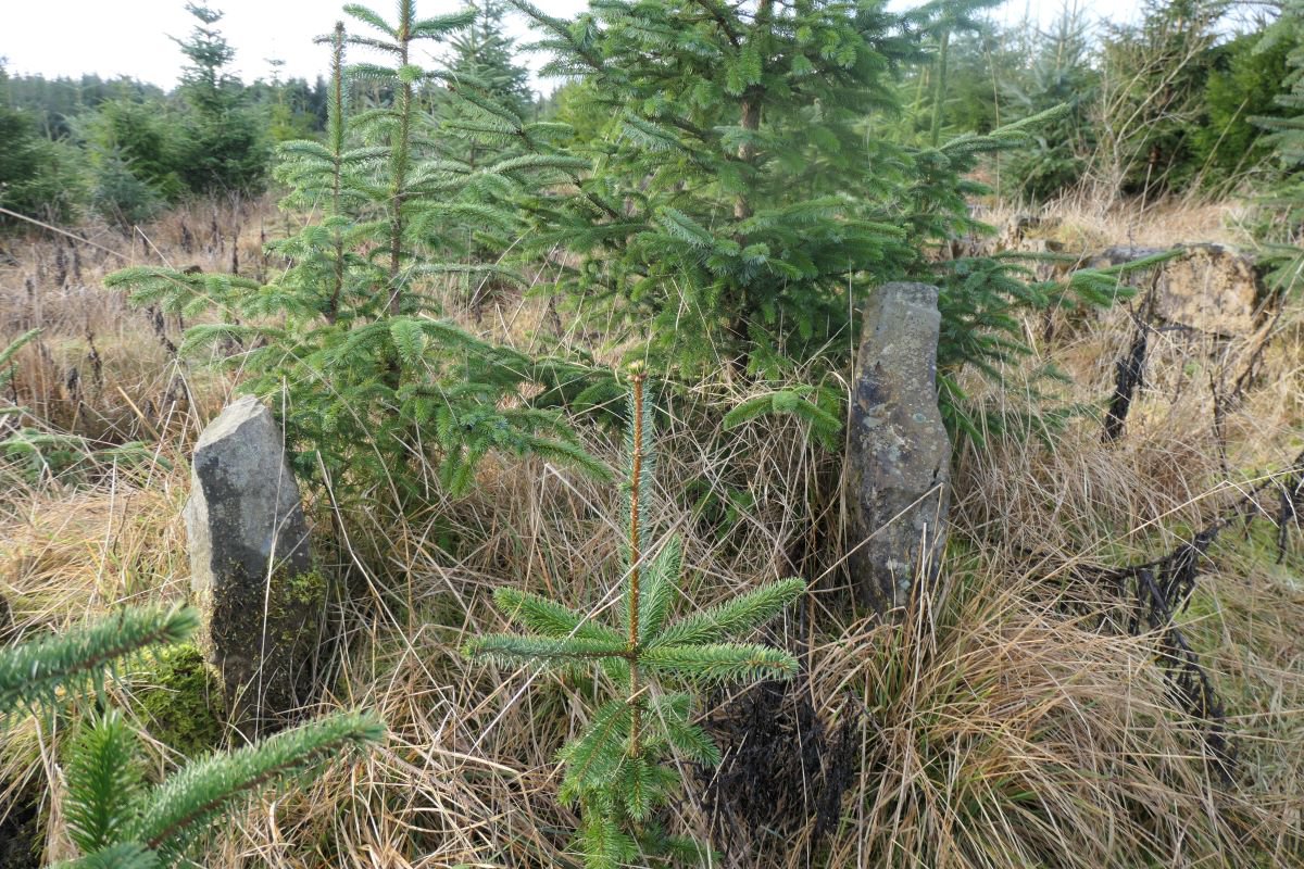
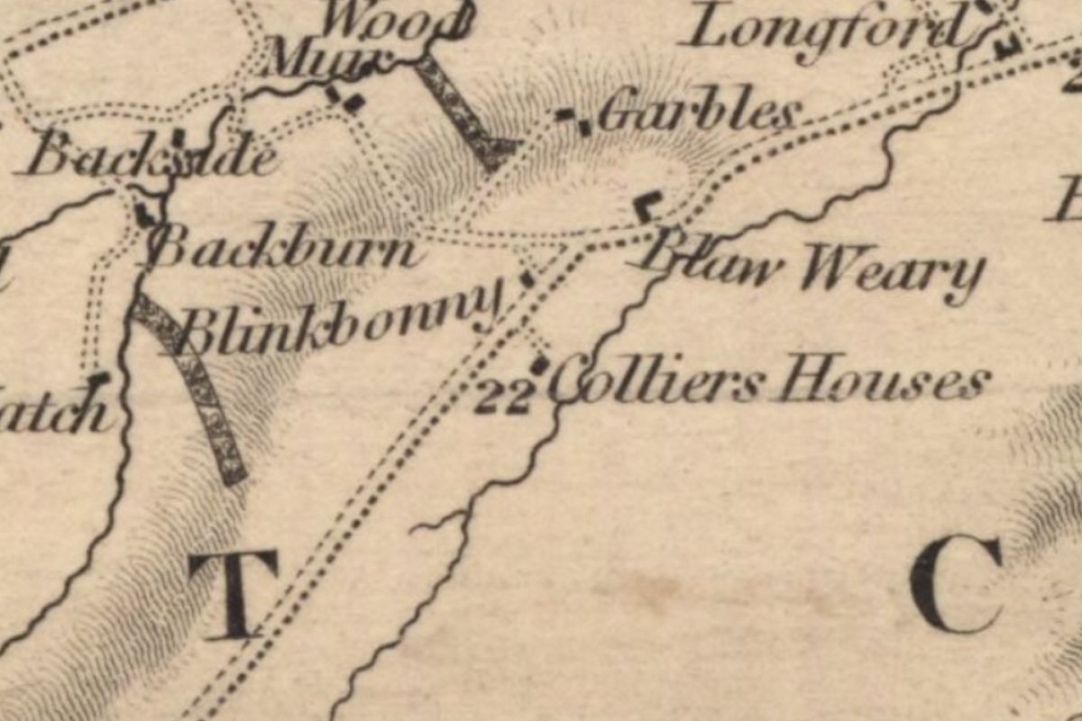
- Longford pit
- Mosside No.1 Pit
- Mosside No.2 pit
- Mosside No.3 pit
- Mosside No.4 mine
- Muckraw mine
- Muirhousedyke pit (1)
- Muirhousedyke pit (2)
- Muldron No.6 pit
- Muldron No.7 pit
- Muldron No.8 pit
- Muldron No.9 pit
- Muldron unidentified pit 1
- Muldron unidentified pit 2
- Muldron unidentified pit 3
- Muldron unidentified pit 4
- Muldron unidentified pit 5
- Muldron unidentified pit 6
- Muldron unidentified pit 7
- Muldron unidentified pit 8
- Muldron unidentified pit 9
- Muldron unidentified pit 11
- Muldron unidentified pit 10
- Muldron unidentified pit 12
- Murieston Limestone Mine
- Murraysgate mine
- North Cobbinshaw coal mine
- Northrigg No.2 pit
- Northrigg No.7 pit
- Northrigg No.1 mine
- Northrigg No.2 mine
- Polkemmet No.5 pit
- Polkemmet No.6 pit
- Polkemmet No.8 pit
- Polkemmet No.9 pit
- Polkemmet Colliery
- Polkemmet No.3 pit
- Polkemmet unidentified pit 1
- Polkemmet unidentified pit 2
- Polkemmet unidentified pit 3
- Polkemmet unidentified pit 4
- Pottishaw No.1 & 2 mine
- Redhouse pit
- Riddochhill No.1 pit
- Riddochhill No.2 pit
- Riddochhill Almond Mines
- Snab pit
- South Broadrigg pit
- Southrigg No. 1 & 2 pits
- Southrigg No. 3 & 4 pits
- Southrigg No. 7 & 8 pits
- Standhill No.1 pit
- Standhill No.2 pit
- Starryshaw No.1 & 2 pits
- Stonehead mine
- Stonehead No.1 pit
- Stonehead No.2 pit
- Stoneheap limestone pit
- Stoneyburn No.1 pit
- Stoneyburn No.2 pit
- Tippethill No.1 & 2 mine
- Torbane No.1 pit
- Torbane No.2 pit
- Torbane No.3 pit
- Torbanehill No.1 pit
- Torbanehill No.2 pit
- Torbanehill No.3 pit
- Torbanehill No.4 pit
- Torbanehill No.5 pit
- Torbanehill No.6 pit
- Torbanehill No.7 pit
- Torbanehill No.8 pit
- Torbanehill No. 9 pit
- Torbanehill No.10 pit
- Torbanehill No.11 pit
- Torbanehill No.12 pit
- Torbanehill No.13 pit
- Torbanehill No.14 pit
- Torbanehill No.15 pit
- Torbanehill No.16 pit
- Torbanehill No.17 pit
- Torbanehill No.18 pit
- Torbanehill No.19 pit
- Torbanehill No.20 pit
- Torbanehill No.21 pit
- Torbanehill No.24 pit
- Torbanehill No.26 pit
- Torbanehill No.29 pit
- Torbanehill Garden Pit
- Trees No.1 pit
- Trees No.2 pit
- Trees No.3 pit
- Wallhouse No.1 mine
- Westallan pit
- Westfield No.1 pit
- Westrigg No.1 pit
- Westrigg No. 2 & 3 pit
- Whitrigg No. 1 & 2 pits
- Whitrigg No. 4 Burnbrae mine
- Whitrigg No. 5 pit
- Whitrigg No.8 & 9 mine
- Woodbank Mine
- Woodend No.1 pit
- Woodend No.2 pit
- Woodend No.3 pit
- Woodend No.4 pit
- Woodend No.5 pit
- Woodmuir No.1 pit
- Woodmuir No.2 pit
- Woodmuir No.3 pit
- Woodmuir No.4 pit
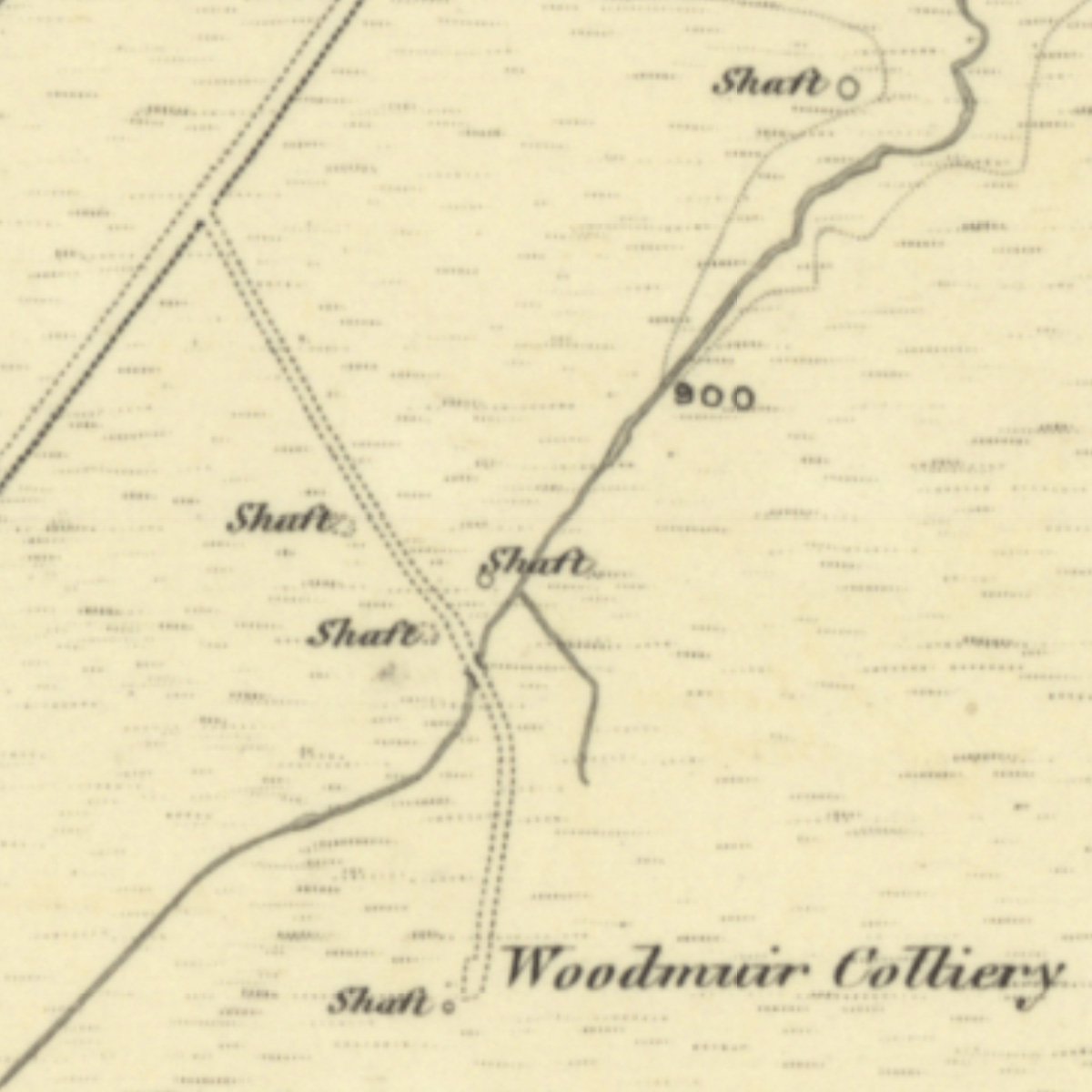
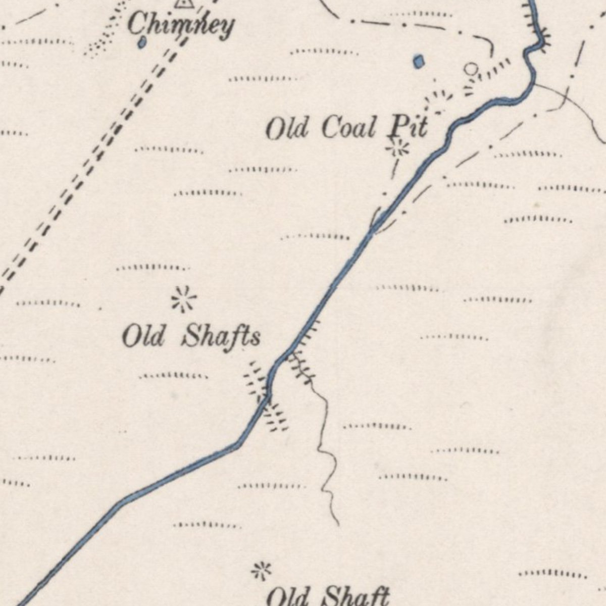
- Woodmuir - early pits (south)
- Woodmuir - early pits (north)