- Badallan pit
- Badallan No.2 mine
- Balbardie - old pits
- Balbardie No.1 pit
- Balbardie No.2 pit
- Balbardie No.2 mine
- Balbardie No.4 pit
- Balbardie No.5 pit
- Ballencreiff fireclay mine
- Ballencrieff - early pits
- Barbauchlaw - early pits
- Barbauchlaw No.1 pit
- Barbauchlaw No.2 pit
- Barbauchlaw No.3 pit
- Barbauchlaw No.4 pit
- Barbauchlaw No.5 pit
- Barbauchlaw No.7 pit
- Barbauchlaw No.9 pit
- Barbauchlaw No.11 pit
- Barbauchlaw No.10 pit
- Barbauchlaw No.12 pit
- Barbauchlaw No.13 pit
- Barbauchlaw No.14 pit
- Barbauchlaw No.15 pit
- Barbauchlaw No.16 pit
- Barbauchlaw No.17 pit
- Barbauchlaw No.18 pit
- Barbauchlaw No.19 pit
- Barbauchlaw No.23 pit
- Barbauchlaw Fireclay and Coal Mine
- Bathgate - old pits
- Bathville No.1 pit
- Bathville No.3 pit
- Bathville No.4 pit
- Bathville No.5 pit
- Bathville unidentified pit 1
- Bathville unidentified pit 2
- Bathville unidentified pit 3
- Benhar (Addie) No.2 pit
- Benhar No.6 and No.14 pits
- Benhar Colliery
- Benhar No.18 pit
- Benhar No.19 pit
- Benhar No.21 pit
- Benhar No.3 pit
- Benhar No.5 pit
- Benhar - old pits
- Benhar unidentified pits
- Benthead No.1 mine
- Benthead unidentified pit 1
- Benthead unidentified pit 2
- Benthead unidentified pit 3
- Benthead unidentified pit 4
- Benthead unidentified pit 5
- Benthead unidentified pit 6
- Bents mine
- Birniehill mine
- Blackrigg No. 1 & 2
- Blackrigg No.3 pit
- Boghead No.1 pit
- Boghead No.2 pit
- Boghead No.3 pit
- Boghead No.4 pit
- Boghead No.5 pit
- Boghead No.6 pit
- Boghead No.8 pit
- Boghead No.9 pit
- Boghead No.10 pit
- Boghead No.11 pit
- Boghead No.12 pit
- Boghead No.14 pit
- Boghead No.15 pit
- Boghead No.25 mine
- Braehead No. 1 pit
- Braehead No.2 pit
- Bridgecastle - early pits
- Bridgehouse - old pits
- Bridgehouse pit
- Brucefield pit
- Camps pit
- Cappers No.1 pit
- Cappers No.2 pit
- Cappers No.3 pit
- Cappers No.4 pit ?
- Colinshiel No.1 pit
- Colinshiel No.2 pit
- Colinshiel No.3 pit
- Colinshiel No.4 pit
- Cowdenhill No.1 Pit
- Craigrigg pit
- Crofthead (Stonehead) No.1 pit
- Crofthead No.2 pit
- Crofthead No.3 pit
- Crofthead No.5 & 6 pit
- Crofthead No.7 pit
- Crofthead (Stonehead) No.7 pit
- Cult pit
- Cultrigg No.1 & No.2 pits
- Cultrigg No.3 pit
- Cultrigg No.4 pit
- Cuthill mines
- Drumcross pits
- Drum No.1 & 2 pits
- Dumback No.1 mine
- Dumback No.2 mine
- East Benhar No.2 mine
- Eastfield No.1 ironstone pit
- Eastfield No.3 ironstone pit
- Eastfield No.3 coal pit
- Eastfield No.4 ironstone pit
- Eastfield No.5 pit
- Eastfield No.6 pit
- Eastfield No.8 ironstone pit
- Eastfield Eagin pit
- Eastfield Engine pit
- Eastfield unidentified pit 1
- East Handaxwood fireclay mine
- Easton No.1 pit
- Eastrigg (Craigrigg) No.1 pit
- Eastrigg (Craigrigg) No.2 pit
- Eastrigg (Craigrigg) No.3 pit
- Fallahill No.3 pit
- Fallahill No.4 pit
- Fauldhouse No.1 pit
- Fauldhouse No.1 (Knowes) pit
- Fauldhouse No.5 pit
- Fauldhouse No.8 pit
- Fauldhouse No.9 pit
- Fauldhouse No.10 pit
- Fauldhouse No.11 pit
- Fauldhouse No.13 pit
- Foulshiels No.1 & No.2 pits
- Gormyre mine
- Goukstane pit
- Greenburn pit
- Greenrigg pit
- Handaxwood No.1 pit
- Handaxwood No.2 pit
- Handaxwood No.3 pit
- Handaxwood No.4 pit
- Handaxwood No.5 pit
- Handaxwood early pits
- Handaxwood unidentified pit 1
- Handaxwood unidentified pit 2
- Handaxwood unidentified pit 3
- Handaxwood unidentified pit 4
- Handaxwood unidentified pit 5
- Handaxwood unidentified pit 6
- Handaxwood unidentified pit 7
- Handaxwood unidentified pit 8
- Handaxwood unidentified pit 12
- Handaxwood unidentified pit 13
- Handaxwood unidentified pit 14
- Handaxwood unidentified pit 15
- Harburn limestone mine
- Harthill No.1 ironstone pit
- Hartrigg or Harthill No.3
- Hartrigg No. 4 & 5 pit
- Heads mine
- Heatherfield No.4 pit
- Heatherfield No.5 pit
- Heatherfield No.6 pit
- Heatherfield No.7 pit
- Hilderston Hill pit
- Hilderston - early pits
- Hopetoun No.2 pit
- Heatherfield No.3 pit
- Hopetoun No.8 pit
- Hopetoun No.9 pit
- Hopetoun No.10 pit
- Hopetoun No.11 pit
- Hopetoun No.12 & 13 pits
- Inchcross No.1 pit
- Inchcross No.2 pit
- Kipps - early pits
- Knowton No.1 & 2 pits
- Latchburn pit
- Leadloch No.1 pit
- Leadloch No.2 pit
- Levenseat No.1 limestone pit
- Levenseat No.2 pit
- Levenseat No.3 limestone pit
- Levenseat No.3 fireclay mine
- Levenseat No.4 fireclay mine
- Levenseat No.1 & 2 fireclay mine
- Levenseat High mine
- Levenseat No.1 limestone mine
- Levenseat quarry limestone mines
- Levenseat unidentified mine
- Loganlea No.1 pit
- Loganlea No.2 pit
- Longford pit
- Mosside No.1 Pit
- Mosside No.2 pit
- Mosside No.3 pit
- Mosside No.4 mine
- Muckraw mine
- Muirhousedyke pit (1)
- Muirhousedyke pit (2)
- Muldron No.6 pit
- Muldron No.7 pit
- Muldron No.8 pit
- Muldron No.9 pit
- Muldron unidentified pit 1
- Muldron unidentified pit 2
- Muldron unidentified pit 3
- Muldron unidentified pit 4
- Muldron unidentified pit 5
- Muldron unidentified pit 6
- Muldron unidentified pit 7
- Muldron unidentified pit 8
- Muldron unidentified pit 9
- Muldron unidentified pit 11
- Muldron unidentified pit 10
- Muldron unidentified pit 12
- Murieston Limestone Mine
- Murraysgate mine
- North Cobbinshaw coal mine
- Northrigg No.2 pit
- Northrigg No.7 pit
- Northrigg No.1 mine
- Northrigg No.2 mine
- Polkemmet No.5 pit
- Polkemmet No.6 pit
- Polkemmet No.8 pit
- Polkemmet No.9 pit
- Polkemmet Colliery
- Polkemmet No.3 pit
- Polkemmet unidentified pit 1
- Polkemmet unidentified pit 2
- Polkemmet unidentified pit 3
- Polkemmet unidentified pit 4
- Pottishaw No.1 & 2 mine
- Redhouse pit
- Riddochhill No.1 pit
- Riddochhill No.2 pit
- Riddochhill Almond Mines
- Snab pit
- South Broadrigg pit
- Southrigg No. 1 & 2 pits
- Southrigg No. 3 & 4 pits
- Southrigg No. 7 & 8 pits
- Standhill No.1 pit
- Standhill No.2 pit
- Starryshaw No.1 & 2 pits
- Stonehead mine
- Stonehead No.1 pit
- Stonehead No.2 pit
- Stoneheap limestone pit
- Stoneyburn No.1 pit
- Stoneyburn No.2 pit
- Tippethill No.1 & 2 mine
- Torbane No.1 pit
- Torbane No.2 pit
- Torbane No.3 pit
- Torbanehill No.1 pit
- Torbanehill No.2 pit
- Torbanehill No.3 pit
- Torbanehill No.4 pit
- Torbanehill No.5 pit
- Torbanehill No.6 pit
- Torbanehill No.7 pit
- Torbanehill No.8 pit
- Torbanehill No. 9 pit
- Torbanehill No.10 pit
- Torbanehill No.11 pit
- Torbanehill No.12 pit
- Torbanehill No.13 pit
- Torbanehill No.14 pit
- Torbanehill No.15 pit
- Torbanehill No.16 pit
- Torbanehill No.17 pit
- Torbanehill No.18 pit
- Torbanehill No.19 pit
- Torbanehill No.20 pit
- Torbanehill No.21 pit
- Torbanehill No.24 pit
- Torbanehill No.26 pit
- Torbanehill No.29 pit
- Torbanehill Garden Pit
- Trees No.1 pit
- Trees No.2 pit
- Trees No.3 pit
- Wallhouse No.1 mine
- Westallan pit
- Westfield No.1 pit
- Westrigg No.1 pit
- Westrigg No. 2 & 3 pit
- Whitrigg No. 1 & 2 pits
- Whitrigg No. 4 Burnbrae mine
- Whitrigg No. 5 pit
- Whitrigg No.8 & 9 mine
- Woodbank Mine
- Woodend No.1 pit
- Woodend No.2 pit
- Woodend No.3 pit
- Woodend No.4 pit
- Woodend No.5 pit
- Woodmuir No.1 pit
- Woodmuir No.2 pit
- Woodmuir No.3 pit
- Woodmuir No.4 pit
- Woodmuir - early pits (south)
- Woodmuir - early pits (north)
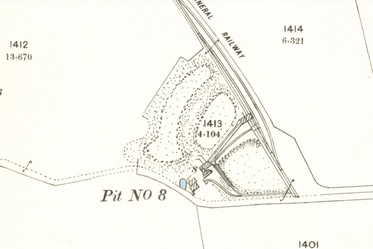
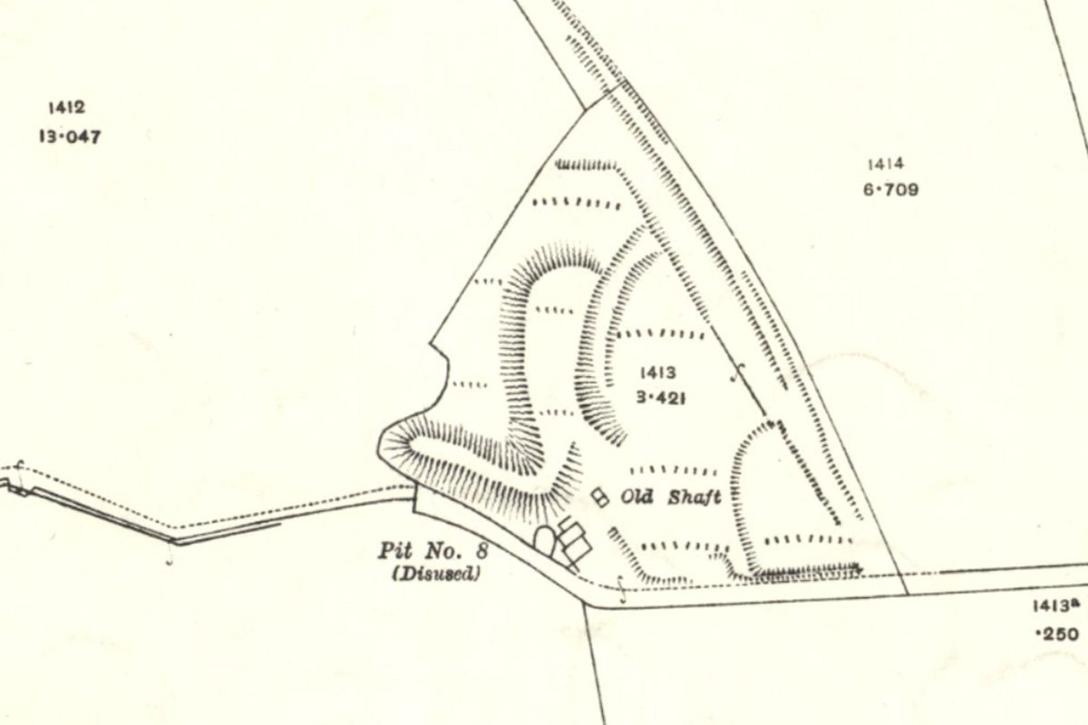
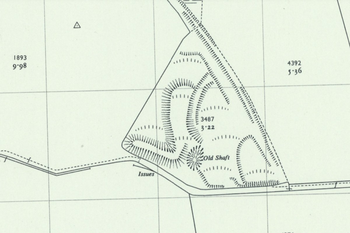
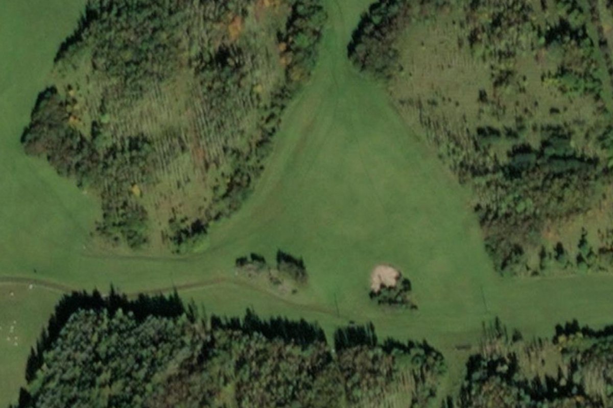
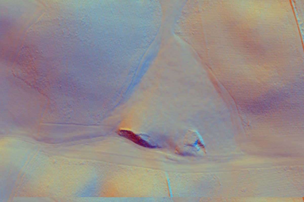
Polkemmet No.8 pit
Pit in the lands of Polkemmet to the Armadale Main coal at 16 fathoms, Armadale Slatyband ironstone at 28 fathoms. Total depth 186ft
The 1883 List of Mines records Polkemmet No.8 pit, owned by the Shotts Iron Co. Ltd. manager Robert Jamieson, working the Black Band Ironstone and gas coal by the longwall method, employing 8 on the surface and 25 underground. The upcast shaft was 8' x 5' and 168 ft deep, and the downcast was 5' x 5' and 104 ft deep. It was a non-fiery mine ventilated by furnace
The 1884 List of Mines records Polkemmet No.8 pit, owned by the Shotts Iron Co. Ltd. manager Robert Jamieson, working the Blackband Ironstone 18”, Gas coal 7” and Rough coal 26” by the longwall and stoop & room methods, employing 11 on the surface and 45 underground. The upcast shaft was 8' x 5' and 168 ft deep, and the downcast was 5' x 5' and 104 ft deep. It was a non-fiery mine ventilated by furnace
The 1885 List of Mines records Polkemmet No.8 pit, owned by the Shotts Iron Co. Ltd. manager Thomas Orr, working the Blackband Ironstone 18”, Gas coal 4” and Rough coal 36” by the longwall and stoop & room methods, employing 8 on the surface and 45 underground. The upcast shaft was 6' x 5' and 168 ft deep, and the downcast was 5' x 4 ½ ' and 156 ft deep. It was a non-fiery mine ventilated by furnace.


