- Badallan pit
- Badallan No.2 mine
- Balbardie - old pits
- Balbardie No.1 pit
- Balbardie No.2 pit
- Balbardie No.2 mine
- Balbardie No.4 pit
- Balbardie No.5 pit
- Ballencreiff fireclay mine
- Ballencrieff - early pits
- Barbauchlaw - early pits
- Barbauchlaw No.1 pit
- Barbauchlaw No.2 pit
- Barbauchlaw No.3 pit
- Barbauchlaw No.4 pit
- Barbauchlaw No.5 pit
- Barbauchlaw No.7 pit
- Barbauchlaw No.9 pit
- Barbauchlaw No.11 pit
- Barbauchlaw No.10 pit
- Barbauchlaw No.12 pit
- Barbauchlaw No.13 pit
- Barbauchlaw No.14 pit
- Barbauchlaw No.15 pit
- Barbauchlaw No.16 pit
- Barbauchlaw No.17 pit
- Barbauchlaw No.18 pit
- Barbauchlaw No.19 pit
- Barbauchlaw No.23 pit
- Barbauchlaw Fireclay and Coal Mine
- Bathgate - old pits
- Bathville No.1 pit
- Bathville No.3 pit
- Bathville No.4 pit
- Bathville No.5 pit
- Bathville unidentified pit 1
- Bathville unidentified pit 2
- Bathville unidentified pit 3
- Benhar (Addie) No.2 pit
- Benhar No.6 and No.14 pits
- Benhar Colliery
- Benhar No.18 pit
- Benhar No.19 pit
- Benhar No.21 pit
- Benhar No.3 pit
- Benhar No.5 pit
- Benhar - old pits
- Benhar unidentified pits
- Benthead No.1 mine
- Benthead unidentified pit 1
- Benthead unidentified pit 2
- Benthead unidentified pit 3
- Benthead unidentified pit 4
- Benthead unidentified pit 5
- Benthead unidentified pit 6
- Bents mine
- Birniehill mine
- Blackrigg No. 1 & 2
- Blackrigg No.3 pit
- Boghead No.1 pit
- Boghead No.2 pit
- Boghead No.3 pit
- Boghead No.4 pit
- Boghead No.5 pit
- Boghead No.6 pit
- Boghead No.8 pit
- Boghead No.9 pit
- Boghead No.10 pit
- Boghead No.11 pit
- Boghead No.12 pit
- Boghead No.14 pit
- Boghead No.15 pit
- Boghead No.25 mine
- Braehead No. 1 pit
- Braehead No.2 pit
- Bridgecastle - early pits
- Bridgehouse - old pits
- Bridgehouse pit
- Brucefield pit
- Camps pit
- Cappers No.1 pit
- Cappers No.2 pit
- Cappers No.3 pit
- Cappers No.4 pit ?
- Colinshiel No.1 pit
- Colinshiel No.2 pit
- Colinshiel No.3 pit
- Colinshiel No.4 pit
- Cowdenhill No.1 Pit
- Craigrigg pit
- Crofthead (Stonehead) No.1 pit
- Crofthead No.2 pit
- Crofthead No.3 pit
- Crofthead No.5 & 6 pit
- Crofthead No.7 pit
- Crofthead (Stonehead) No.7 pit
- Cult pit
- Cultrigg No.1 & No.2 pits
- Cultrigg No.3 pit
- Cultrigg No.4 pit
- Cuthill mines
- Drumcross pits
- Drum No.1 & 2 pits
- Dumback No.1 mine
- Dumback No.2 mine
- East Benhar No.2 mine
- Eastfield No.1 ironstone pit
- Eastfield No.3 ironstone pit
- Eastfield No.3 coal pit
- Eastfield No.4 ironstone pit
- Eastfield No.5 pit
- Eastfield No.6 pit
- Eastfield No.8 ironstone pit
- Eastfield Eagin pit
- Eastfield Engine pit
- Eastfield unidentified pit 1
- East Handaxwood fireclay mine
- Easton No.1 pit
- Eastrigg (Craigrigg) No.1 pit
- Eastrigg (Craigrigg) No.2 pit
- Eastrigg (Craigrigg) No.3 pit
- Fallahill No.3 pit
- Fallahill No.4 pit
- Fauldhouse No.1 pit
- Fauldhouse No.1 (Knowes) pit
- Fauldhouse No.5 pit
- Fauldhouse No.8 pit
- Fauldhouse No.9 pit
- Fauldhouse No.10 pit
- Fauldhouse No.11 pit
- Fauldhouse No.13 pit
- Foulshiels No.1 & No.2 pits
- Gormyre mine
- Goukstane pit
- Greenburn pit
- Greenrigg pit
- Handaxwood No.1 pit
- Handaxwood No.2 pit
- Handaxwood No.3 pit
- Handaxwood No.4 pit
- Handaxwood No.5 pit
- Handaxwood early pits
- Handaxwood unidentified pit 1
- Handaxwood unidentified pit 2
- Handaxwood unidentified pit 3
- Handaxwood unidentified pit 4
- Handaxwood unidentified pit 5
- Handaxwood unidentified pit 6
- Handaxwood unidentified pit 7
- Handaxwood unidentified pit 8
- Handaxwood unidentified pit 12
- Handaxwood unidentified pit 13
- Handaxwood unidentified pit 14
- Handaxwood unidentified pit 15
- Harburn limestone mine
- Harthill No.1 ironstone pit
- Hartrigg or Harthill No.3
- Hartrigg No. 4 & 5 pit
- Heads mine
- Heatherfield No.4 pit
- Heatherfield No.5 pit
- Heatherfield No.6 pit
- Heatherfield No.7 pit
- Hilderston Hill pit
- Hilderston - early pits
- Hopetoun No.2 pit
- Heatherfield No.3 pit
- Hopetoun No.8 pit
- Hopetoun No.9 pit
- Hopetoun No.10 pit
- Hopetoun No.11 pit
- Hopetoun No.12 & 13 pits
- Inchcross No.1 pit
- Inchcross No.2 pit
- Kipps - early pits
- Knowton No.1 & 2 pits
- Latchburn pit
- Leadloch No.1 pit
- Leadloch No.2 pit
- Levenseat No.1 limestone pit
- Levenseat No.2 pit
- Levenseat No.3 limestone pit
- Levenseat No.3 fireclay mine
- Levenseat No.4 fireclay mine
- Levenseat No.1 & 2 fireclay mine
- Levenseat High mine
- Levenseat No.1 limestone mine
- Levenseat quarry limestone mines
- Levenseat unidentified mine
- Loganlea No.1 pit
- Loganlea No.2 pit
- Longford pit
- Mosside No.1 Pit
- Mosside No.2 pit
- Mosside No.3 pit
- Mosside No.4 mine
- Muckraw mine
- Muirhousedyke pit (1)
- Muirhousedyke pit (2)
- Muldron No.6 pit
- Muldron No.7 pit
- Muldron No.8 pit
- Muldron No.9 pit
- Muldron unidentified pit 1
- Muldron unidentified pit 2
- Muldron unidentified pit 3
- Muldron unidentified pit 4
- Muldron unidentified pit 5
- Muldron unidentified pit 6
- Muldron unidentified pit 7
- Muldron unidentified pit 8
- Muldron unidentified pit 9
- Muldron unidentified pit 11
- Muldron unidentified pit 10
- Muldron unidentified pit 12
- Murieston Limestone Mine
- Murraysgate mine
- North Cobbinshaw coal mine
- Northrigg No.2 pit
- Northrigg No.7 pit
- Northrigg No.1 mine
- Northrigg No.2 mine
- Polkemmet No.5 pit
- Polkemmet No.6 pit
- Polkemmet No.8 pit
- Polkemmet No.9 pit
- Polkemmet Colliery
- Polkemmet No.3 pit
- Polkemmet unidentified pit 1
- Polkemmet unidentified pit 2
- Polkemmet unidentified pit 3
- Polkemmet unidentified pit 4
- Pottishaw No.1 & 2 mine
- Redhouse pit
- Riddochhill No.1 pit
- Riddochhill No.2 pit
- Riddochhill Almond Mines
- Snab pit
- South Broadrigg pit
- Southrigg No. 1 & 2 pits
- Southrigg No. 3 & 4 pits
- Southrigg No. 7 & 8 pits
- Standhill No.1 pit
- Standhill No.2 pit
- Starryshaw No.1 & 2 pits
- Stonehead mine
- Stonehead No.1 pit
- Stonehead No.2 pit
- Stoneheap limestone pit
- Stoneyburn No.1 pit
- Stoneyburn No.2 pit
- Tippethill No.1 & 2 mine
- Torbane No.1 pit
- Torbane No.2 pit
- Torbane No.3 pit
- Torbanehill No.1 pit
- Torbanehill No.2 pit
- Torbanehill No.3 pit
- Torbanehill No.4 pit
- Torbanehill No.5 pit
- Torbanehill No.6 pit
- Torbanehill No.7 pit
- Torbanehill No.8 pit
- Torbanehill No. 9 pit
- Torbanehill No.10 pit
- Torbanehill No.11 pit
- Torbanehill No.12 pit
- Torbanehill No.13 pit
- Torbanehill No.14 pit
- Torbanehill No.15 pit
- Torbanehill No.16 pit
- Torbanehill No.17 pit
- Torbanehill No.18 pit
- Torbanehill No.19 pit
- Torbanehill No.20 pit
- Torbanehill No.21 pit
- Torbanehill No.24 pit
- Torbanehill No.26 pit
- Torbanehill No.29 pit
- Torbanehill Garden Pit
- Trees No.1 pit
- Trees No.2 pit
- Trees No.3 pit
- Wallhouse No.1 mine
- Westallan pit
- Westfield No.1 pit
- Westrigg No.1 pit
- Westrigg No. 2 & 3 pit
- Whitrigg No. 1 & 2 pits
- Whitrigg No. 4 Burnbrae mine
- Whitrigg No. 5 pit
- Whitrigg No.8 & 9 mine
- Woodbank Mine
- Woodend No.1 pit
- Woodend No.2 pit
- Woodend No.3 pit
- Woodend No.4 pit
- Woodend No.5 pit
- Woodmuir No.1 pit
- Woodmuir No.2 pit
- Woodmuir No.3 pit
- Woodmuir No.4 pit
- Woodmuir - early pits (south)
- Woodmuir - early pits (north)
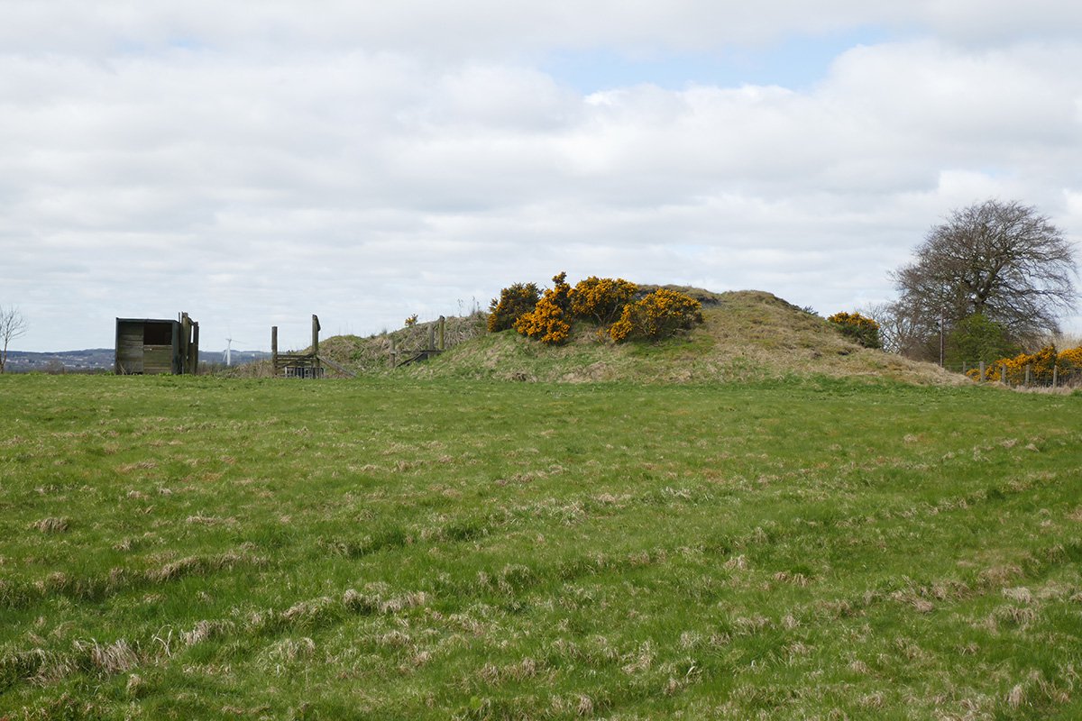
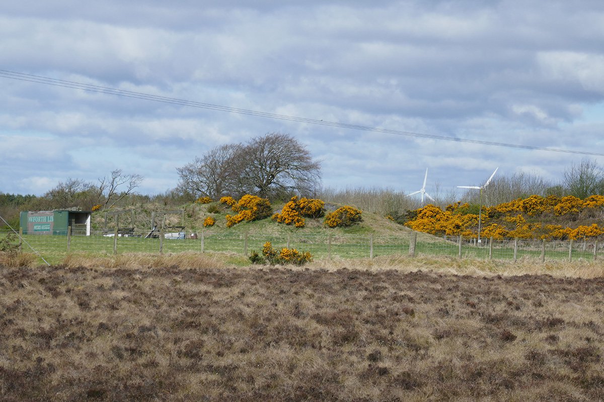
Cappers No.2 pit
An early ironstone pit in the lands of Polkemmet, to the Boghead Gas Coal at 32 fathoms. Total depth 141 ft. Cappers No.2 appears to have been erroneously labelled as Cappers No.1 (and vica versa) on Ordnance Survey maps.
This pit is situated a short distance S.W. of "Snab" and N.W. of Cappers Plantation - It is 24 fathoms in depth and worked by an engine 15 horse power, The seam including Parrot & Rough Coal & Ironstone is from 2 feet 10 inches to 3 feet 6 inches in thickness - It is worked by the Shotts Iron Company
OS Name Book
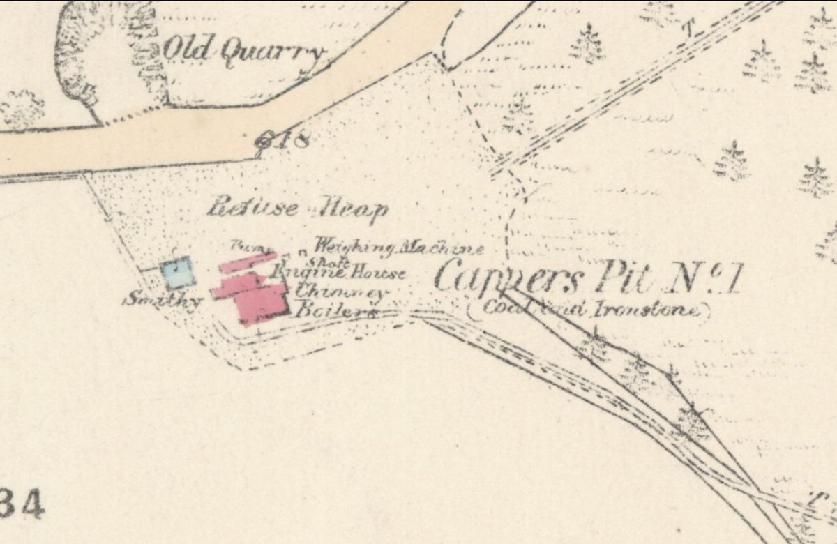
25" OS map c.1855, courtesy National Library of Scotland
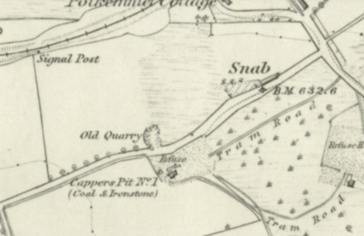
6" OS map c.1855, courtesy National Library of Scotland
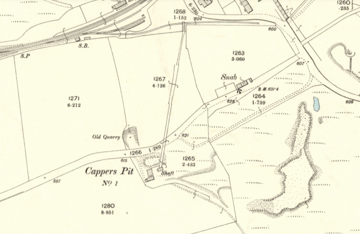
25" OS map c.1895, courtesy National Library of Scotland
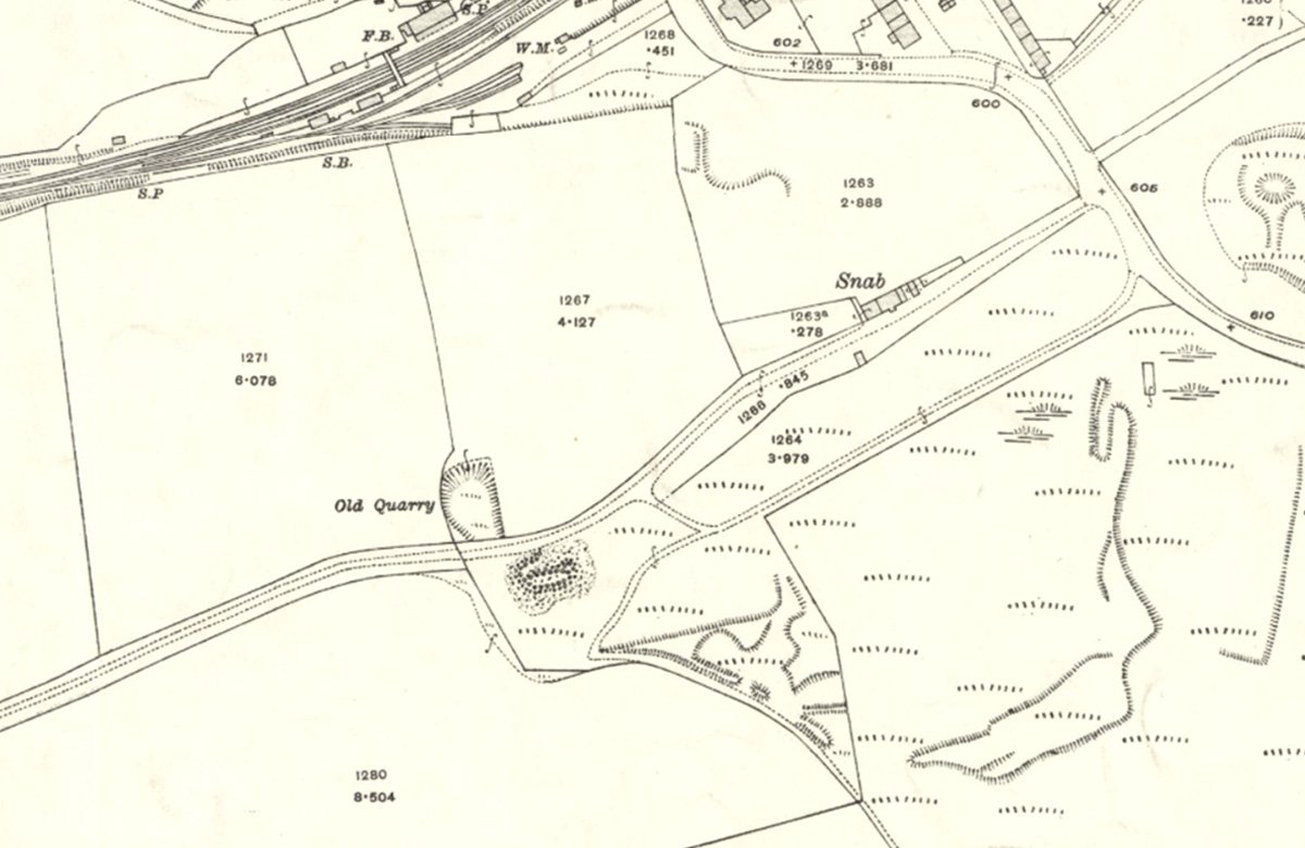
25" OS map c.1914, courtesy National Library of Scotland
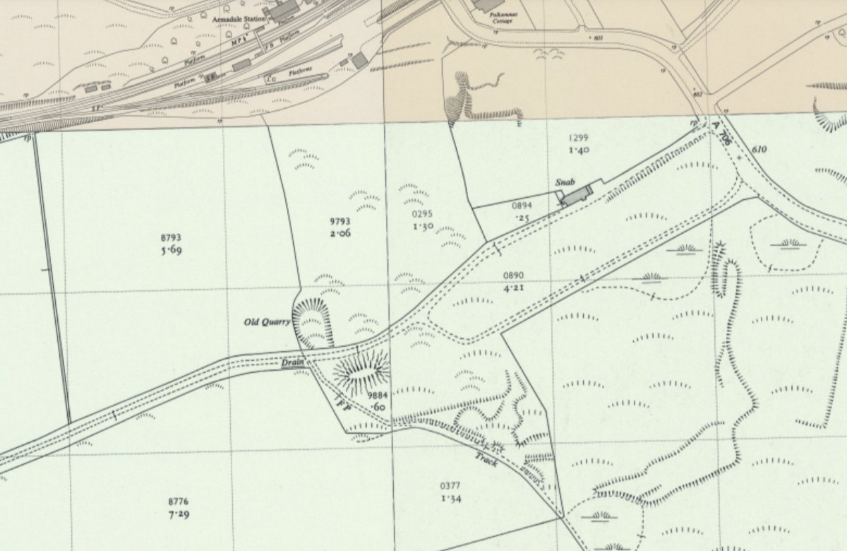
1:2500 OS map c.1956, courtesy National Library of Scotland
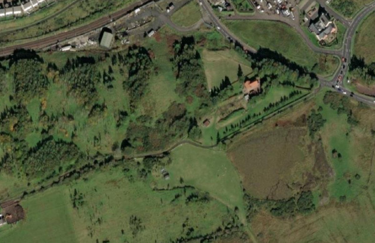
aerial view
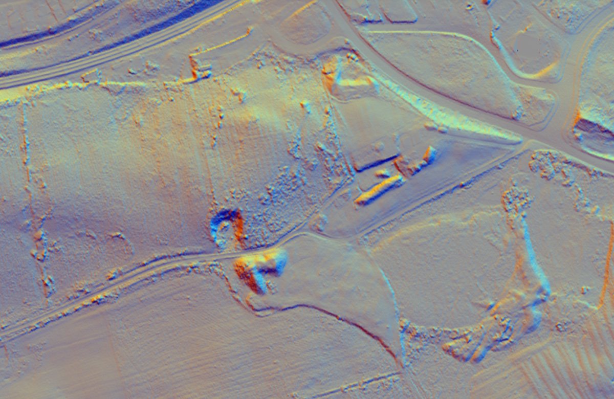
lidar view
References
The Weather Clerk celebrated the 25th anniversary of the fall of the Tay Bridge last Thursday night or Friday morning by blowing down the bridge that spans the space from the hillside to the railway siding at No. 2 Pit, Cappers. The bridge was used to convey hutches from the pithead to the railway, and was built of wood. The damage will be repaired in time for the works opening.
Linlithgowshire Gazette, 6th January 1905


