- Addiewell No.1 pit
- Addiewell No.1 mine
- Addiewell No.2 pit
- Addiewell No.2 mine
- Addiewell No.3 pit
- Addiewell No.3 mine
- Addiewell No.4 pit
- Addiewell No.5 pit
- Addiewell No.6 pit
- Addiewell No.18 mine
- Albyn mine
- Alderstone No.43 mine
- Baads No.9 pit
- Baads No.15 pit
- Baads No.17 mine
- Baads No.22 pit
- Baads No.23 pit
- Baads No.42 mine
- Boghall No.1 pit
- Boghall No.2 coal pit
- Boghall No.3 pit
- Boghall No.4 pit
- Boghall "Raeburn" mine
- Breichdykes pits
- Breich No. 1 & 2 pits
- Burngrange No. 1 & 2 pits
- Burngrange No. 39 mine
- Burntisland No.1 mine
- Burntisland No.2 mine
- Burntisland No.3 mine
- Burntisland No.4 mine
- Carledubs mine
- Champfleurie mine
- Cobbinshaw No.1 & 2 mines
- Cobbinshaw No.5 mine
- Cobbinshaw South No. 1 pit
- Cobbinshaw South No.28 mine
- Cobbinshaw South No.3 mine
- Cobbinshaw (West Calder Oil) pit
- Cousland No.1 mine
- Cousland No.2 mine
- Crossgreen No.1, 2, & 3 mines
- Cuthill No.24 coal mine
- Dalmeny No.1 pit
- Dalmeny No.2 pit
- Dalmeny No.3 pit
- Dalmeny Railway No.1 & 2 mines
- Deans (Caputhall) mine
- Deans No.1 mine
- Deans No.2 mine
- Deans No.3 mine
- Deans No.3 mine & quarry (W.L.O.C.)
- Deans No.4 mine
- Deans No.4 pit
- Deans No.5 mine
- Deans No.6 mine
- Deans No.7 mine
- Drumcrosshall No1. & No.2 mines
- Drumshoreland Muir pit
- Duddingston No. 1 & 2 mines
- Duddingston No.3 mine & quarry
- Dunnet or Sandholes mine
- Dunnet's mine, East Hermand
- Easter Breich coal mine
- Easter Breich No.1 & 2 pits
- Fivestanks mine
- Fivestanks; unidentified mine
- Forkneuk No.1 & 2 pits
- Forkneuk No.38 mine
- Forkneuk No.9 & 10 pits
- Fraser pit
- Gavieside No.1 pit
- Gavieside No.2 pit
- Gavieside No.3 pit
- Gavieside No.40 mine
- Grange No.1 & 2 pits
- Grange No.3 pit
- Greendykes North mine
- Greendykes South mine
- Greenfield No.1 pit
- Greenfield No.3 mine
- Hartwood mine & coal pit
- Hayscraigs mines and quarries
- Hermand mine
- Hermand (Murray's pool) mine
- Hermand No.5 pit
- Hermand No.6 mine
- Hillend coal pit
- Holmes mine
- Hopetoun No.35 pit
- Hopetoun No.4 mine
- Hopetoun No.1 pit
- Hopetoun No.2 pit
- Hopetoun No.3 mine
- Hopetoun No.41 (Fawnspark) mine
- Hopetoun No.44 mine
- Hopetoun No.5 pit
- Hopetoun No.6 (Glendevon) mines
- Hut mines and quarry
- Ingliston No.33 pit
- Ingliston No.36 & 37 pits
- Lawhead No.1 mine
- Limefield No.32 mine
- Livingston quarries
- Mid Breich No.2 mine
- Mid Breich No.3 pit
- Mid Breich No.4 pit
- Mortonhall No.10 mine
- Mortonhall No.9 mine
- Muirhall No.16 coal mine
- Muirhall No.19 coal pit
- Newbigging No.1 & 2 mines
- Newfarm No.3 & 4 mines
- Newliston No.29 mine
- North Cobbinshaw mine
- Oakbank: Calder wood mine
- Oakbank No.1 & 2 pits
- Ochiltree Colliery - north
- Ochiltree Colliery - south
- Ochiltree No.2 mine
- Ochiltree No.3 mine
- Ochiltree No.5 mine
- Ochiltree No.6 mine
- Pentland No.1 & 2 mines
- Philpstoun No. 1 mine
- Philpstoun No. 1 (Whitequarries) mine
- Philpstoun No. 2 mine
- Philpstoun No. 3 mine
- Philpstoun No. 4 (grey) mine & quarry
- Philpstoun No. 4 mine
- Philpstoun No. 5 mine
- Philpstoun No. 6 (Whitequarries) mine
- Philpstoun No.7 mine
- Polbeth No. 8 pit
- Polbeth No.10 pit
- Polbeth No. 11 pit
- Polbeth No. 20 mine
- Polbeth No. 21 mine
- Polbeth No. 26 mine
- Polbeth No. 27 mine
- Polbeth No. 31 mine
- Polbeth No. 7 & 7½ pits
- Pumpherston No.1 mine
- Pumpherston No.2 mine
- Pumpherston No.3 mine
- Pumpherston No.4 mine
- Pumpherston No.5 mine
- Pumpherston No.6 mine
- Pyothall No.5 pit
- Redhouse No.1 coal mine
- Roman Camp (Cawburn) mine
- Roman Camp No.1 mine
- Roman Camp No.3 mine
- Roman Camp No.4 pit
- Roman Camp No.5 mine
- Roman Camp No.6 mine
- Roman Camp No.7 mine
- Roman Camp (north) No.2 mine
- Roman Camp (south) No.2 mine
- Rosshill No.1 & 2 mines
- Seafield coal mine
- Seafield No.1 mine
- Seafield No.3 mine
- Stankards No.1 pit
- Stankards No.45 mine
- Stewartfield No.1 mine
- Stewartfield No.1 pit
- Stewartfield No.2 mine
- Stewartfield No.2 pit
- Stewartfield No.3 pit
- Stewartfield No.4 pit
- Straiton No.1 & 2 mines
- Straiton No.3 pit & No.3 mine
- Straiton No.4 mine
- Straiton No.8 mine
- Strathbrock collieries
- Tarbrax No.1 pit
- Tarbrax No.2 pit
- Tottleywells No.1 mine
- Viewfield coal pit
- Viewfield No. 4 & 5 pits
- Westwood No.12 pit
- Westwood No.1 & 2 pits
- Westwood No.13 pit
- Westwood No.30 pit
- Woolfords colliery
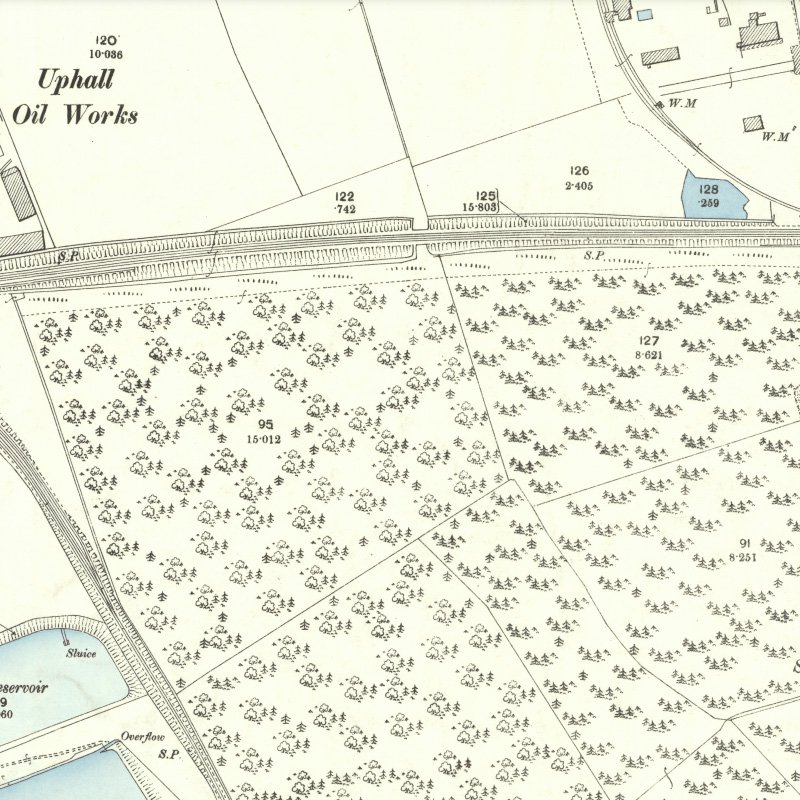
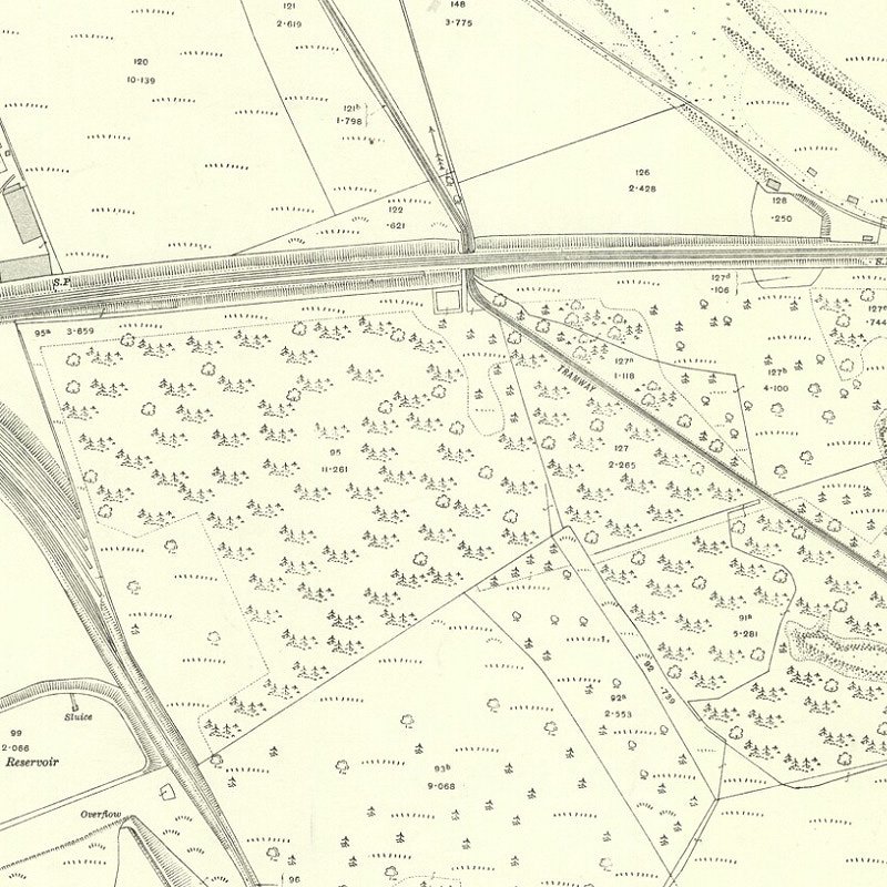
Roman Camp No.5 mine
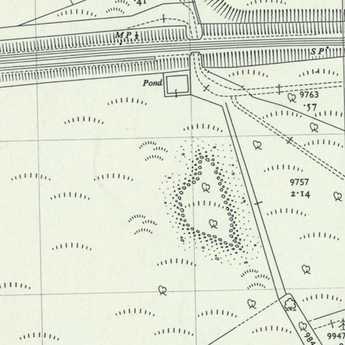
Inclined adit
Serving Roman Camp Oil Works
A mine exploiting reserves of Camps Shale to the north west of the mine entrance. The larger part of the Camps Shale in this area was exploited from Pumpherston No. 4 Mine.
Shale-field: Pumpherston shale-field.
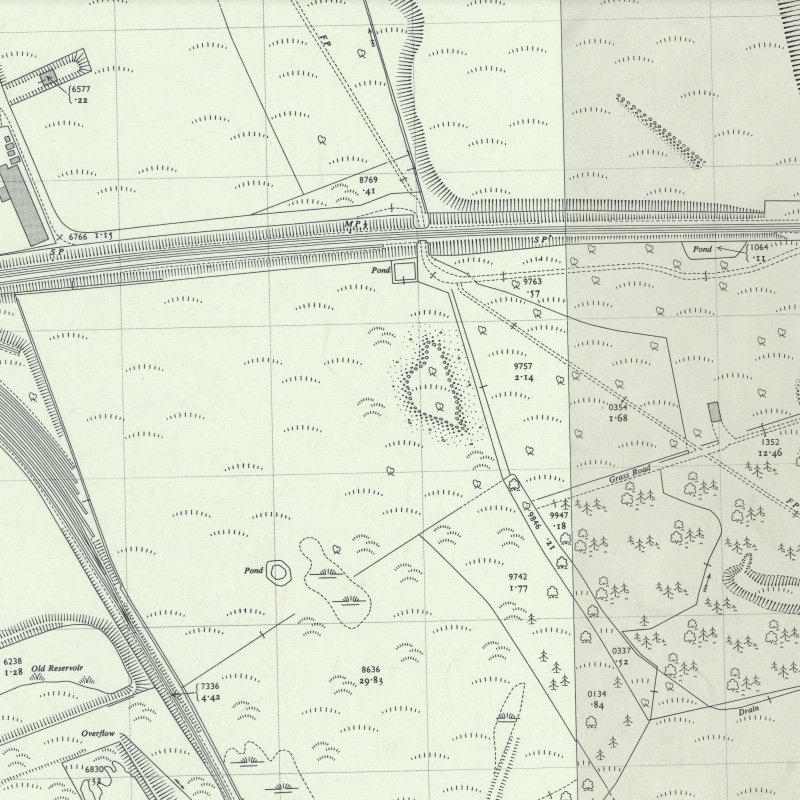
Mapped by the Ordnance Survey of c.1955 showing waste bing from No. 5 Mine
Recent images
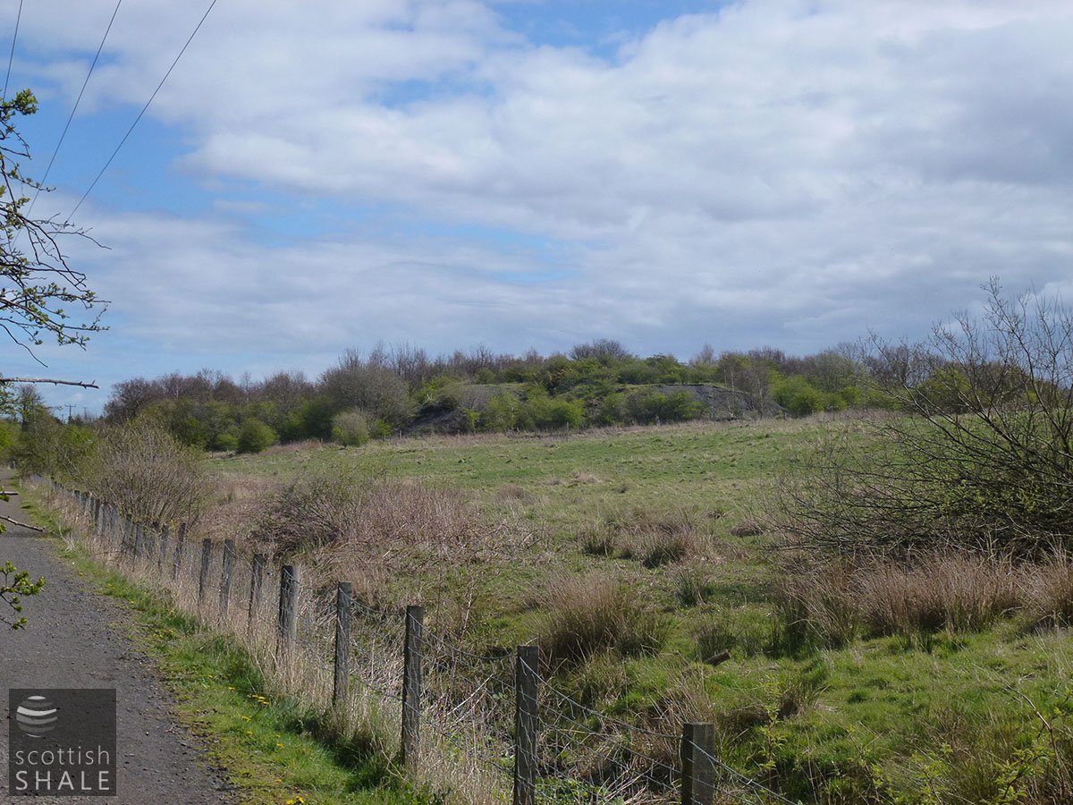
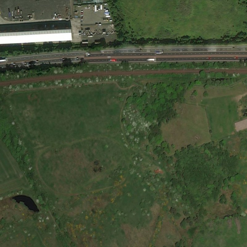
Waste bing of Roman Camp No. 5 Mine viewed from beside the Edinburgh - Bathgate railway. Looking east. April 2012.
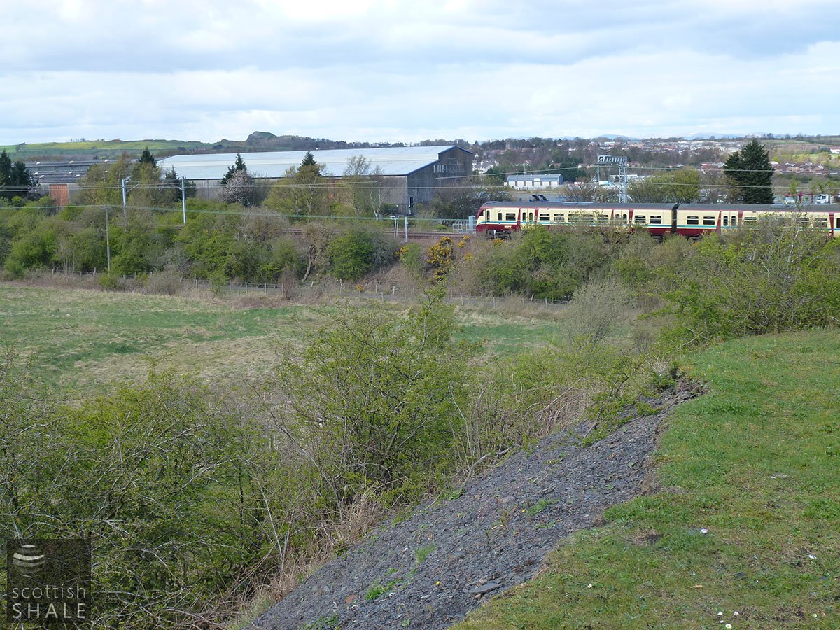
View from waste bing looking towards Uphall, with Binny Craig on the horizon. Looking north west. April 2012.
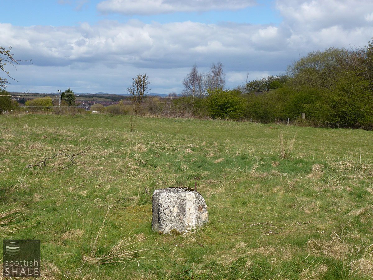
Concrete foundation (of a mast or pylon?) to the south west of the mine bing. Looking north west. April 2012.
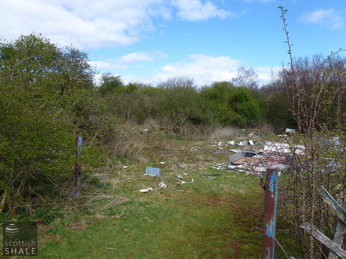
Derelict ground immediately south of the mine bing. Looking north. April 2012.
At No.5 mine several places on the north side, which are approaching the whin dyke referred to in the last report, are in a very poor condition and a number of them are being stopped (May 1924). We are experiencing difficulties in the neighbourhood of the whin dyke (June 1924). The inclination of the seam changed from 35 to vertical, but the dook was carried on at a gradient of 35 and the shale found rising at an angle of 30, showing that a very deep trough had been crossed (June 1925). We are expected to reach the flat ground by this time, but the seam is still lying steeply with no sign of a change (January 1925).
From Scottish Oils Ltd, Managing Director's Monthly Report to the Board. (BP Archive No. 215662)
Coal Authority Mine Abandonment Catalogue No. 11160, showing workings in the Camps Shale, abandoned in 1934.


