- Addiewell No.1 pit
- Addiewell No.1 mine
- Addiewell No.2 pit
- Addiewell No.2 mine
- Addiewell No.3 pit
- Addiewell No.3 mine
- Addiewell No.4 pit
- Addiewell No.5 pit
- Addiewell No.6 pit
- Addiewell No.18 mine
- Albyn mine
- Alderstone No.43 mine
- Baads No.9 pit
- Baads No.15 pit
- Baads No.17 mine
- Baads No.22 pit
- Baads No.23 pit
- Baads No.42 mine
- Boghall No.1 pit
- Boghall No.2 coal pit
- Boghall No.3 pit
- Boghall No.4 pit
- Boghall "Raeburn" mine
- Breichdykes pits
- Breich No. 1 & 2 pits
- Burngrange No. 1 & 2 pits
- Burngrange No. 39 mine
- Burntisland No.1 mine
- Burntisland No.2 mine
- Burntisland No.3 mine
- Burntisland No.4 mine
- Carledubs mine
- Champfleurie mine
- Cobbinshaw No.1 & 2 mines
- Cobbinshaw No.5 mine
- Cobbinshaw South No. 1 pit
- Cobbinshaw South No.28 mine
- Cobbinshaw South No.3 mine
- Cobbinshaw (West Calder Oil) pit
- Cousland No.1 mine
- Cousland No.2 mine
- Crossgreen No.1, 2, & 3 mines
- Cuthill No.24 coal mine
- Dalmeny No.1 pit
- Dalmeny No.2 pit
- Dalmeny No.3 pit
- Dalmeny Railway No.1 & 2 mines
- Deans (Caputhall) mine
- Deans No.1 mine
- Deans No.2 mine
- Deans No.3 mine
- Deans No.3 mine & quarry (W.L.O.C.)
- Deans No.4 mine
- Deans No.4 pit
- Deans No.5 mine
- Deans No.6 mine
- Deans No.7 mine
- Drumcrosshall No1. & No.2 mines
- Drumshoreland Muir pit
- Duddingston No. 1 & 2 mines
- Duddingston No.3 mine & quarry
- Dunnet or Sandholes mine
- Dunnet's mine, East Hermand
- Easter Breich coal mine
- Easter Breich No.1 & 2 pits
- Fivestanks mine
- Fivestanks; unidentified mine
- Forkneuk No.1 & 2 pits
- Forkneuk No.38 mine
- Forkneuk No.9 & 10 pits
- Fraser pit
- Gavieside No.1 pit
- Gavieside No.2 pit
- Gavieside No.3 pit
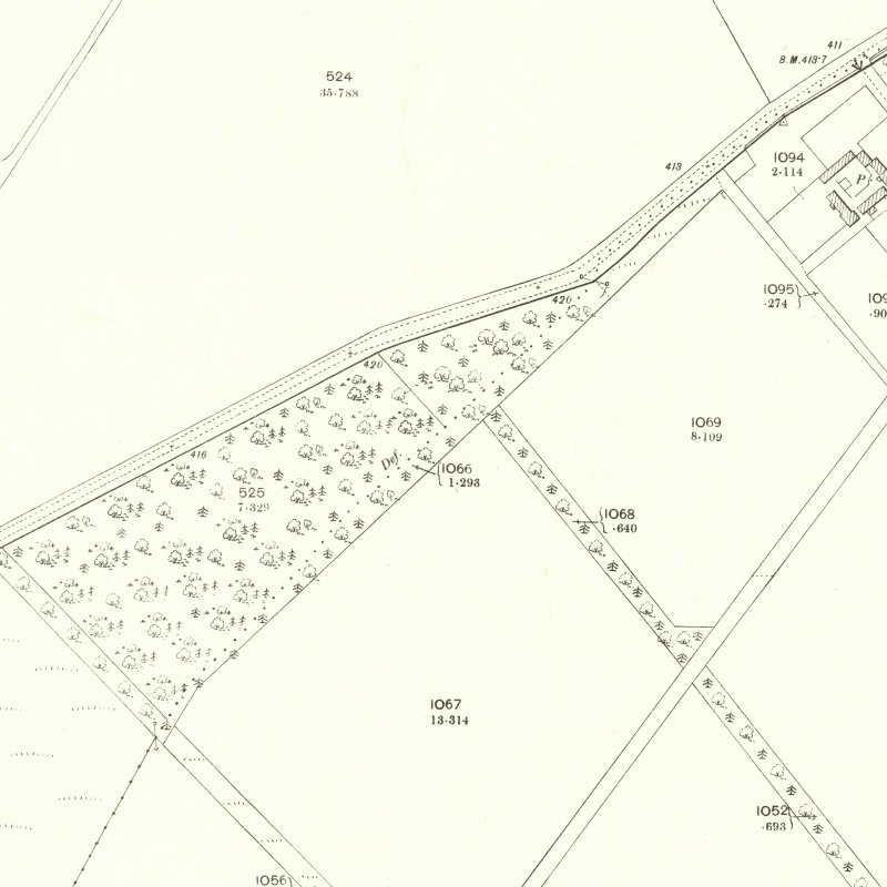
- Gavieside No.40 mine
- Grange No.1 & 2 pits
- Grange No.3 pit
- Greendykes North mine
- Greendykes South mine
- Greenfield No.1 pit
- Greenfield No.3 mine
- Hartwood mine & coal pit
- Hayscraigs mines and quarries
- Hermand mine
- Hermand (Murray's pool) mine
- Hermand No.5 pit
- Hermand No.6 mine
- Hillend coal pit
- Holmes mine
- Hopetoun No.35 pit
- Hopetoun No.4 mine
- Hopetoun No.1 pit
- Hopetoun No.2 pit
- Hopetoun No.3 mine
- Hopetoun No.41 (Fawnspark) mine
- Hopetoun No.44 mine
- Hopetoun No.5 pit
- Hopetoun No.6 (Glendevon) mines
- Hut mines and quarry
- Ingliston No.33 pit
- Ingliston No.36 & 37 pits
- Lawhead No.1 mine
- Limefield No.32 mine
- Livingston quarries
- Mid Breich No.2 mine
- Mid Breich No.3 pit
- Mid Breich No.4 pit
- Mortonhall No.10 mine
- Mortonhall No.9 mine
- Muirhall No.16 coal mine
- Muirhall No.19 coal pit
- Newbigging No.1 & 2 mines
- Newfarm No.3 & 4 mines
- Newliston No.29 mine
- North Cobbinshaw mine
- Oakbank: Calder wood mine
- Oakbank No.1 & 2 pits
- Ochiltree Colliery - north
- Ochiltree Colliery - south
- Ochiltree No.2 mine
- Ochiltree No.3 mine
- Ochiltree No.5 mine
- Ochiltree No.6 mine
- Pentland No.1 & 2 mines
- Philpstoun No. 1 mine
- Philpstoun No. 1 (Whitequarries) mine
- Philpstoun No. 2 mine
- Philpstoun No. 3 mine
- Philpstoun No. 4 (grey) mine & quarry
- Philpstoun No. 4 mine
- Philpstoun No. 5 mine
- Philpstoun No. 6 (Whitequarries) mine
- Philpstoun No.7 mine
- Polbeth No. 8 pit
- Polbeth No.10 pit
- Polbeth No. 11 pit
- Polbeth No. 20 mine
- Polbeth No. 21 mine
- Polbeth No. 26 mine
- Polbeth No. 27 mine
- Polbeth No. 31 mine
- Polbeth No. 7 & 7½ pits
- Pumpherston No.1 mine
- Pumpherston No.2 mine
- Pumpherston No.3 mine
- Pumpherston No.4 mine
- Pumpherston No.5 mine
- Pumpherston No.6 mine
- Pyothall No.5 pit
- Redhouse No.1 coal mine
- Roman Camp (Cawburn) mine
- Roman Camp No.1 mine
- Roman Camp No.3 mine
- Roman Camp No.4 pit
- Roman Camp No.5 mine
- Roman Camp No.6 mine
- Roman Camp No.7 mine
- Roman Camp (north) No.2 mine
- Roman Camp (south) No.2 mine
- Rosshill No.1 & 2 mines
- Seafield coal mine
- Seafield No.1 mine
- Seafield No.3 mine
- Stankards No.1 pit
- Stankards No.45 mine
- Stewartfield No.1 mine
- Stewartfield No.1 pit
- Stewartfield No.2 mine
- Stewartfield No.2 pit
- Stewartfield No.3 pit
- Stewartfield No.4 pit
- Straiton No.1 & 2 mines
- Straiton No.3 pit & No.3 mine
- Straiton No.4 mine
- Straiton No.8 mine
- Strathbrock collieries
- Tarbrax No.1 pit
- Tarbrax No.2 pit
- Tottleywells No.1 mine
- Viewfield coal pit
- Viewfield No. 4 & 5 pits
- Westwood No.12 pit
- Westwood No.1 & 2 pits
- Westwood No.13 pit
- Westwood No.30 pit
- Woolfords colliery
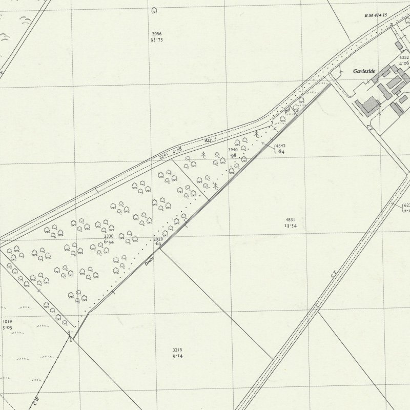
Gavieside No.40 mine
Inclined shaft to the Dunnet shale
Supplied Addiewell Oil Works
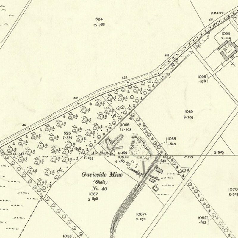
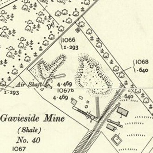
An inclined mine to the Dunnet Shale, sometimes referred to as Charlesfield mine, linked by a standard gauge mineral line to the Polbeth and Addiewell Railway.
Mapped by the Ordnance Survey of c.1907 showing the mine in production.
Drawings
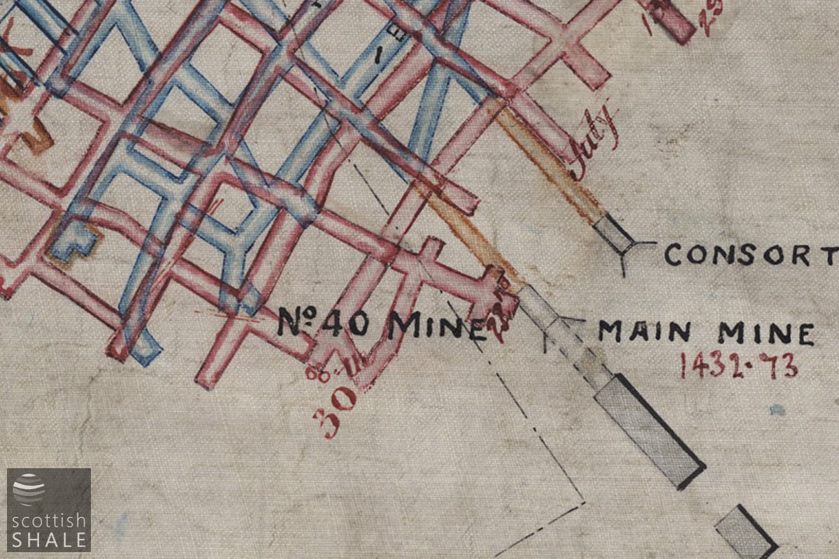
Section of mine plan, aligned with OS map. (courtesy British Geological Survey LSP49, 15658-01).
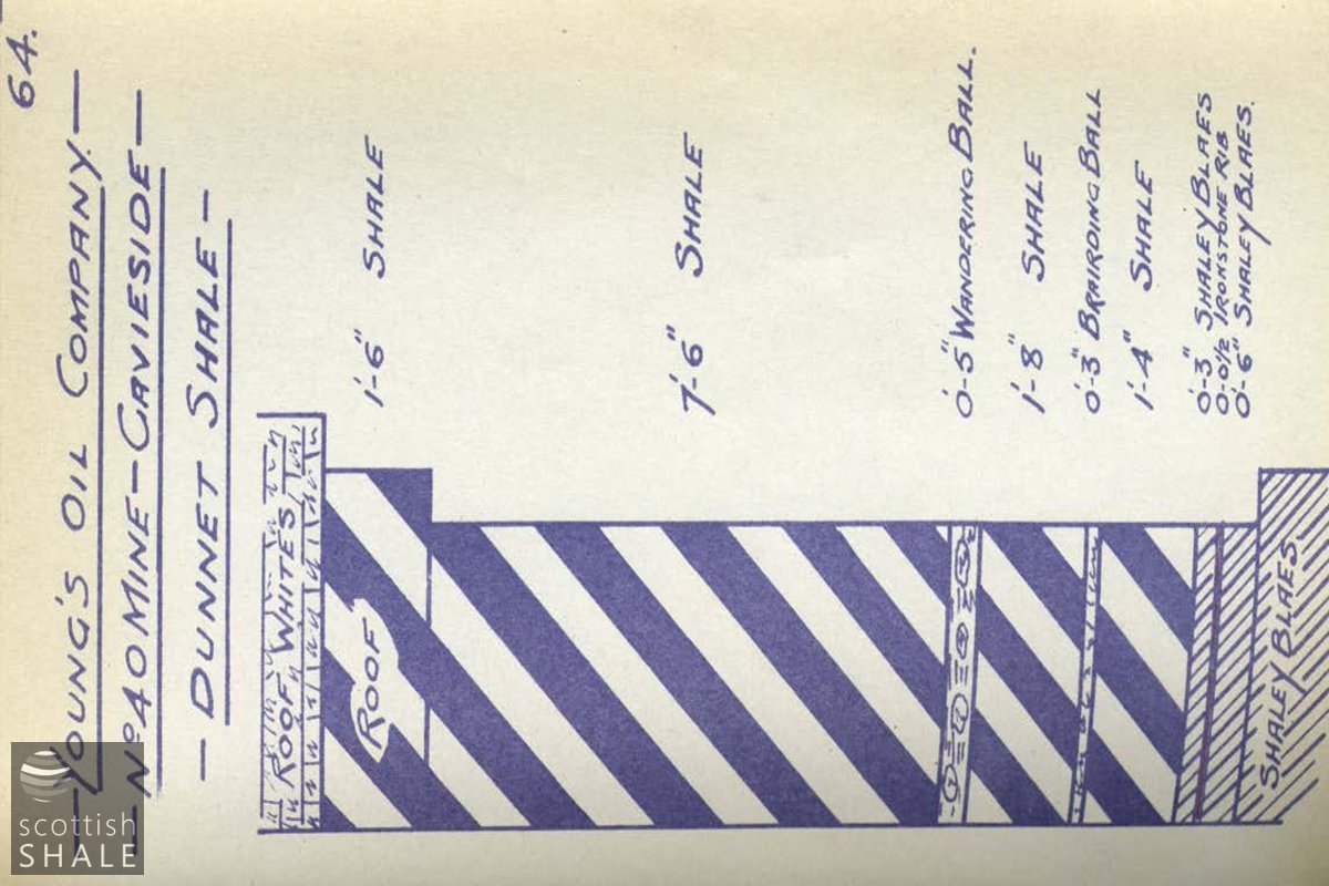
From "Sections of Shale Seams", a notebook by Robert Crichton. (BP Archive 183734)
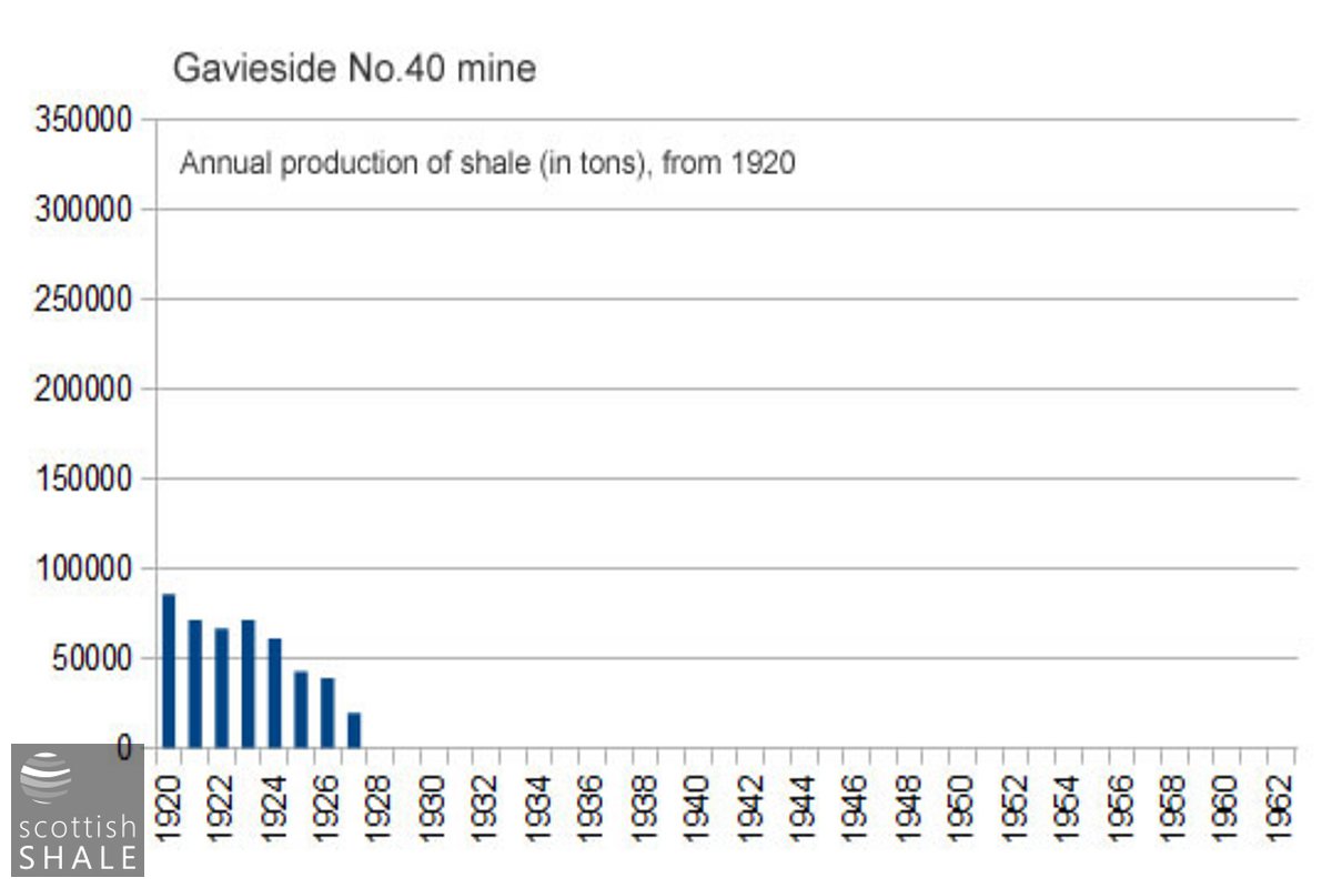
Production statistics from 1920.
Recent images
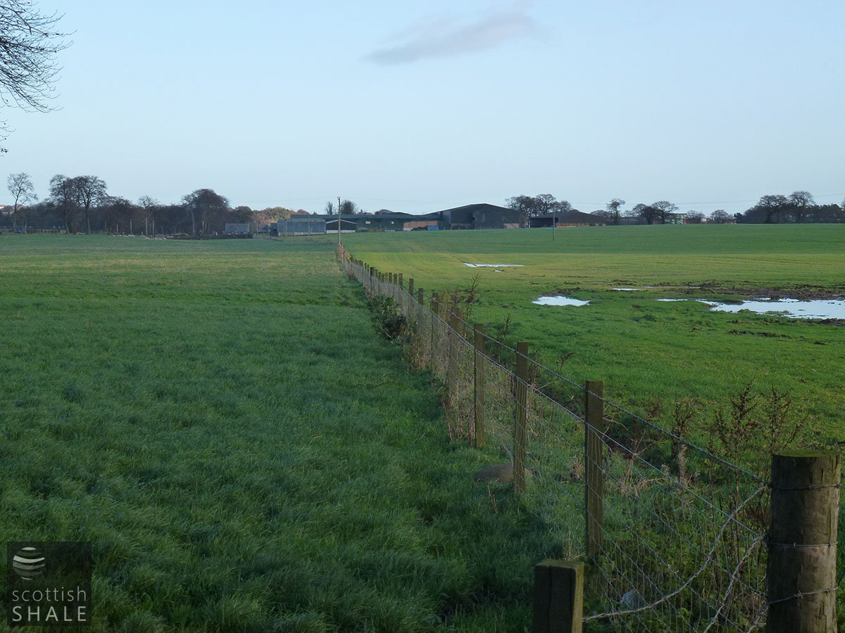
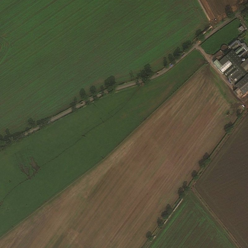
View looking towards Gavieside farm; the pools of water marking subsidence on the mine site. Looking north east. November 2011.
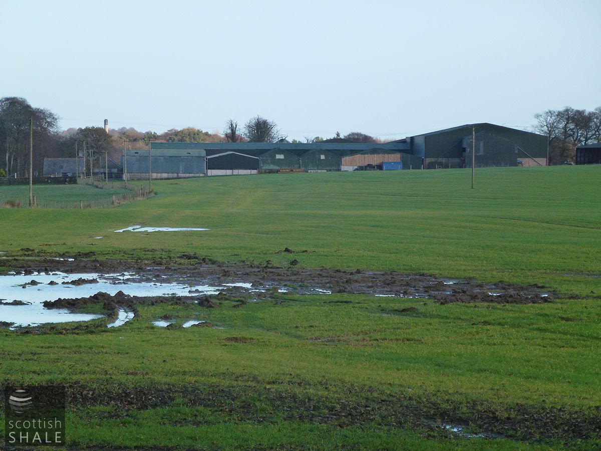
Telephoto view of (1) with site of adit marked by the area of flooding. Looking north east. November 2011.
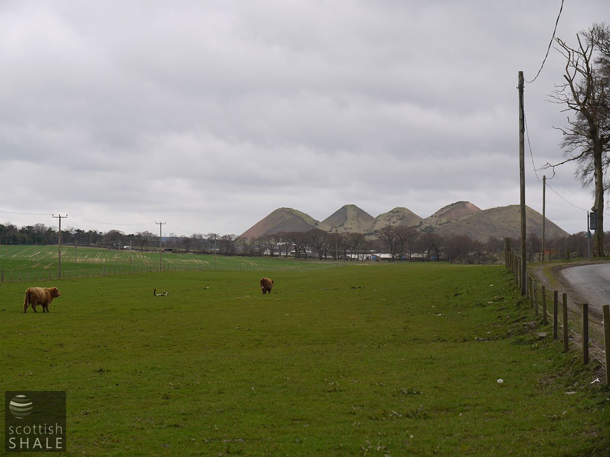
Looking towards the Five Sisters bing. November 2011.
The Dunnet Shale is at present being opened out by the new Gavieside mine, where the shale... varies from 6 – 16 feet, but its general working thickness is about 10 feet.
Oil Shales of the Lothians; British Geological Survey, 1906
.......
ADDIEWELL SHALE MINES - THREATENED CLOSURE
YOUNG'S OIL COMPANY, Addiewell, has posted notices at the works and mines stating that their lease of the Polbeth minerals expires at Whitsunday 1925. The Company has had prolonged negotiations with the landlords for a renewal thereof, but the parties have been unable to come to terms. It may, therefore, be necessary at 28th May to discontinue operations at Polbeth and Gavieside Shale Mines, and also at Addiewell Oil Works. The Company regret having to notify all workers at these mines and works that, on and after 15th May, work will be continued on the footing of all workers being subject to one day's notice. The situation has given rise to a feeling of anxiety in the district, as a large body of workmen will be affected if a stoppage takes place.
Scotsman, 5th May 1925
- Coal Authority Mine Abandonment Catalogue No. 9057, showing workings in the Dunnet and the Under Dunnet or Barracks Shale from Gavieside No. 40, abandoned in 1927
- Agreement No. 357. Licence under the Explosives Act for a powder magazine at Gavieside, August 1904. Young's Paraffin Light & Mineral Oil Company Ltd; Inventory of Leases, Agreements &c. BP Archive 215854
- Agreement No. 364. Licence under the Explosives Act for a mixed explosives store at No. 40 mine, Gavieside, May 1906. Young's Paraffin Light & Mineral Oil Company Ltd; Inventory of Leases, Agreements &c. BP Archive 215854
- Agreement No. 473. Licence under the Explosives Act for a mixed explosives store at No. 40 mine, Gavieside, in a small locked box at the pithead, March 1911. Young's Paraffin Light & Mineral Oil Company Ltd; Inventory of Leases, Agreements &c. BP Archive 215854
- Oral history transcript: Mr A Balloch
- Oral history transcript: Mr James Brown
- Oral history transcript: Mr Ellis & Mr Ellis
- Oral history transcript: Mr David Mackie
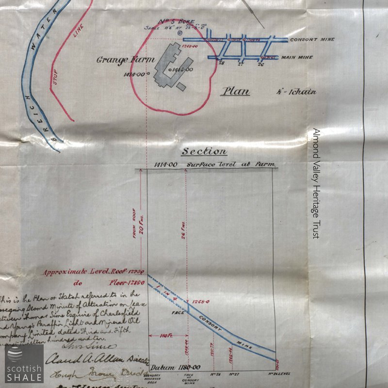
- 195313 - Duplicate Lease between Thomas Sime, Esquire and Youngâs Paraffin Light and Mineral Oil Company Limited re Charlesfield Minerals. 1900. - Duplicate Lease between Thomas Sime, Esquire and Youngâs Paraffin Light and Mineral Oil Company Limited re Charlesfield Minerals. Entry at Martinmas 1900; endurance 23.5 years; expiry Whitsunday 1926. Dated 10th, 14th, 17th, 19th July 1922. Hand written with signatures. Includes 3 plans. Plan entitled Dunnet Shael, No.40 mine Gavieside, showing the workings approaching Grange Farm. Shows proposed extension of main and consort mines in red. Scale 1" to 100'. Plan showing are of mineral lease at Charlesfield as referred to in the document. Shows the area besdie the Breich water near Gavieside with area bounded in red. Scale 1.2 " to 100'. Dated 7th and 8th November 1900. Plan entiteld' no.40 Mine, Gavieside, Workngs under Grange Farm'. Dated 3rd and 5th August 1910. Shows workings under the farm and farm buildings. Scale 0.5" to 1 chain. Also a section from the surface level at farm down. Scale- verticals 0.5"to 20', horizontals- 0.5" to 66 '.


