- Addiewell No.1 pit
- Addiewell No.1 mine
- Addiewell No.2 pit
- Addiewell No.2 mine
- Addiewell No.3 pit
- Addiewell No.3 mine
- Addiewell No.4 pit
- Addiewell No.5 pit
- Addiewell No.6 pit
- Addiewell No.18 mine
- Albyn mine
- Alderstone No.43 mine
- Baads No.9 pit
- Baads No.15 pit
- Baads No.17 mine
- Baads No.22 pit
- Baads No.23 pit
- Baads No.42 mine
- Boghall No.1 pit
- Boghall No.2 coal pit
- Boghall No.3 pit
- Boghall No.4 pit
- Boghall "Raeburn" mine
- Breichdykes pits
- Breich No. 1 & 2 pits
- Burngrange No. 1 & 2 pits
- Burngrange No. 39 mine
- Burntisland No.1 mine
- Burntisland No.2 mine
- Burntisland No.3 mine
- Burntisland No.4 mine
- Carledubs mine
- Champfleurie mine
- Cobbinshaw No.1 & 2 mines
- Cobbinshaw No.5 mine
- Cobbinshaw South No. 1 pit
- Cobbinshaw South No.28 mine
- Cobbinshaw South No.3 mine
- Cobbinshaw (West Calder Oil) pit
- Cousland No.1 mine
- Cousland No.2 mine
- Crossgreen No.1, 2, & 3 mines
- Cuthill No.24 coal mine
- Dalmeny No.1 pit
- Dalmeny No.2 pit
- Dalmeny No.3 pit
- Dalmeny Railway No.1 & 2 mines
- Deans (Caputhall) mine
- Deans No.1 mine
- Deans No.2 mine
- Deans No.3 mine
- Deans No.3 mine & quarry (W.L.O.C.)
- Deans No.4 mine
- Deans No.4 pit
- Deans No.5 mine
- Deans No.6 mine
- Deans No.7 mine
- Drumcrosshall No1. & No.2 mines
- Drumshoreland Muir pit
- Duddingston No. 1 & 2 mines
- Duddingston No.3 mine & quarry
- Dunnet or Sandholes mine
- Dunnet's mine, East Hermand
- Easter Breich coal mine
- Easter Breich No.1 & 2 pits
- Fivestanks mine
- Fivestanks; unidentified mine
- Forkneuk No.1 & 2 pits
- Forkneuk No.38 mine
- Forkneuk No.9 & 10 pits
- Fraser pit
- Gavieside No.1 pit
- Gavieside No.2 pit
- Gavieside No.3 pit
- Gavieside No.40 mine
- Grange No.1 & 2 pits
- Grange No.3 pit
- Greendykes North mine
- Greendykes South mine
- Greenfield No.1 pit
- Greenfield No.3 mine
- Hartwood mine & coal pit
- Hayscraigs mines and quarries
- Hermand mine
- Hermand (Murray's pool) mine
- Hermand No.5 pit
- Hermand No.6 mine
- Hillend coal pit
- Holmes mine
- Hopetoun No.35 pit
- Hopetoun No.4 mine
- Hopetoun No.1 pit
- Hopetoun No.2 pit
- Hopetoun No.3 mine
- Hopetoun No.41 (Fawnspark) mine
- Hopetoun No.44 mine
- Hopetoun No.5 pit
- Hopetoun No.6 (Glendevon) mines
- Hut mines and quarry
- Ingliston No.33 pit
- Ingliston No.36 & 37 pits
- Lawhead No.1 mine
- Limefield No.32 mine
- Livingston quarries
- Mid Breich No.2 mine
- Mid Breich No.3 pit
- Mid Breich No.4 pit
- Mortonhall No.10 mine
- Mortonhall No.9 mine
- Muirhall No.16 coal mine
- Muirhall No.19 coal pit
- Newbigging No.1 & 2 mines
- Newfarm No.3 & 4 mines
- Newliston No.29 mine
- North Cobbinshaw mine
- Oakbank: Calder wood mine
- Oakbank No.1 & 2 pits
- Ochiltree Colliery - north
- Ochiltree Colliery - south
- Ochiltree No.2 mine
- Ochiltree No.3 mine
- Ochiltree No.5 mine
- Ochiltree No.6 mine
- Pentland No.1 & 2 mines
- Philpstoun No. 1 mine
- Philpstoun No. 1 (Whitequarries) mine
- Philpstoun No. 2 mine
- Philpstoun No. 3 mine
- Philpstoun No. 4 (grey) mine & quarry
- Philpstoun No. 4 mine
- Philpstoun No. 5 mine
- Philpstoun No. 6 (Whitequarries) mine
- Philpstoun No.7 mine
- Polbeth No. 8 pit
- Polbeth No.10 pit
- Polbeth No. 11 pit
- Polbeth No. 20 mine
- Polbeth No. 21 mine
- Polbeth No. 26 mine
- Polbeth No. 27 mine
- Polbeth No. 31 mine
- Polbeth No. 7 & 7½ pits
- Pumpherston No.1 mine
- Pumpherston No.2 mine
- Pumpherston No.3 mine
- Pumpherston No.4 mine
- Pumpherston No.5 mine
- Pumpherston No.6 mine
- Pyothall No.5 pit
- Redhouse No.1 coal mine
- Roman Camp (Cawburn) mine
- Roman Camp No.1 mine
- Roman Camp No.3 mine
- Roman Camp No.4 pit
- Roman Camp No.5 mine
- Roman Camp No.6 mine
- Roman Camp No.7 mine
- Roman Camp (north) No.2 mine
- Roman Camp (south) No.2 mine
- Rosshill No.1 & 2 mines
- Seafield coal mine
- Seafield No.1 mine
- Seafield No.3 mine
- Stankards No.1 pit
- Stankards No.45 mine
- Stewartfield No.1 mine
- Stewartfield No.1 pit
- Stewartfield No.2 mine
- Stewartfield No.2 pit
- Stewartfield No.3 pit
- Stewartfield No.4 pit
- Straiton No.1 & 2 mines
- Straiton No.3 pit & No.3 mine
- Straiton No.4 mine
- Straiton No.8 mine
- Strathbrock collieries
- Tarbrax No.1 pit
- Tarbrax No.2 pit
- Tottleywells No.1 mine
- Viewfield coal pit
- Viewfield No. 4 & 5 pits
- Westwood No.12 pit
- Westwood No.1 & 2 pits
- Westwood No.13 pit
- Westwood No.30 pit
- Woolfords colliery
Forkneuk No.1 & 2 pits
Vertical shaft
Serving Uphall Oil Works
An early pit, closed in 1886, but subsequently linked to the workings of Forkneuk No. 9 & 10 Pits, to the south, and Forkneuk No. 38 Mine to the north. Linked by standard gauge railway to Uphall Oil Works.
The pit site lies within a grazed area pock-marked with subsidence. No trace remains of any pithead buildings.
Shale-field: Broxburn District.
Mapped by the Ordnance Survey of c.1895, showing no trace of the pit.
Drawings
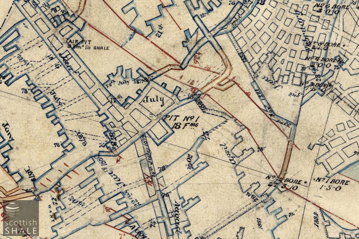
Detail of mine abandonment plan (Courtesy British Geological Survey LSP 58 - 15649).
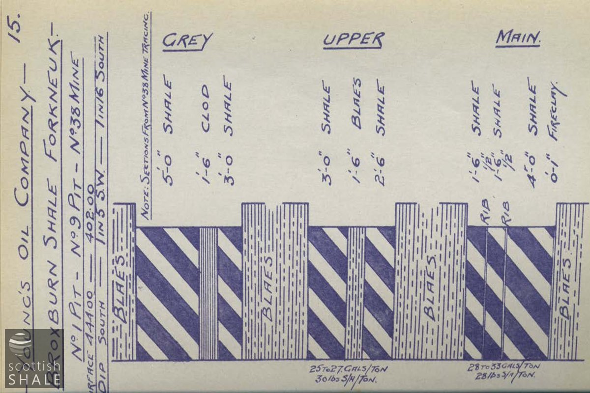
From "Sections of Shale Seams", a notebook by Robert Crichton. BP Archive 183734
Recent images
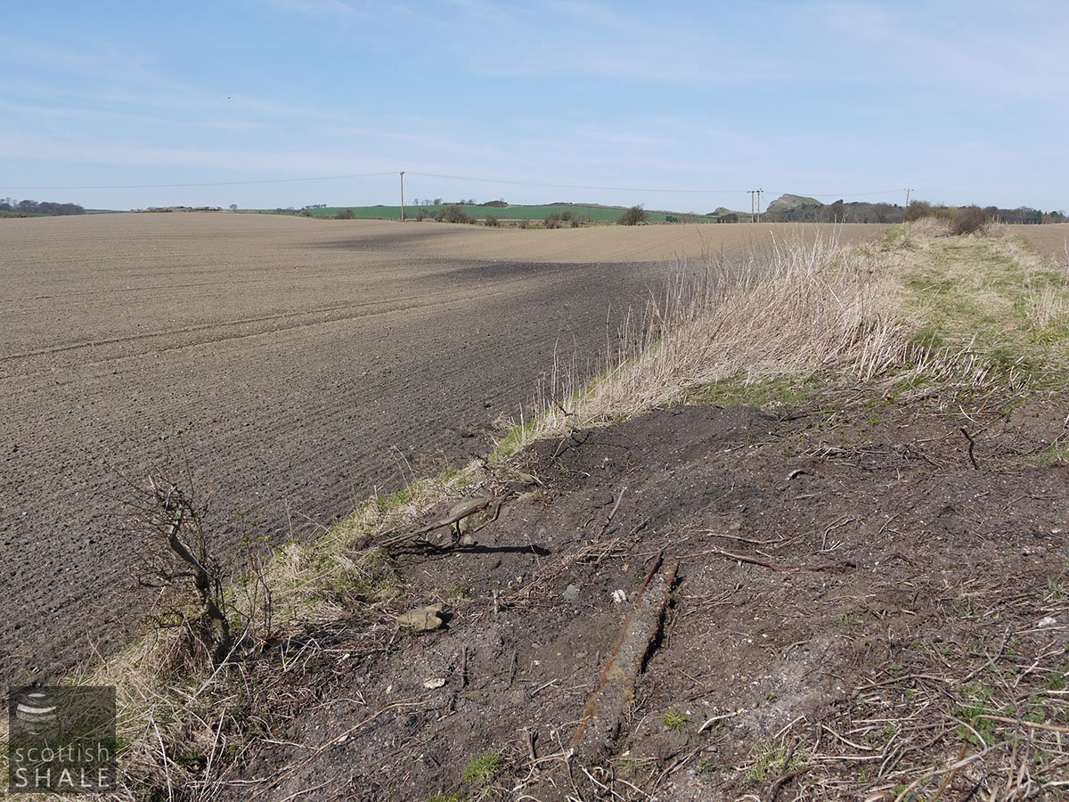
View from mineral railway (with a length of rail exposed), showing branch siding to No. 1 Pit as a dark stain in the field. Looking north. April 2009.
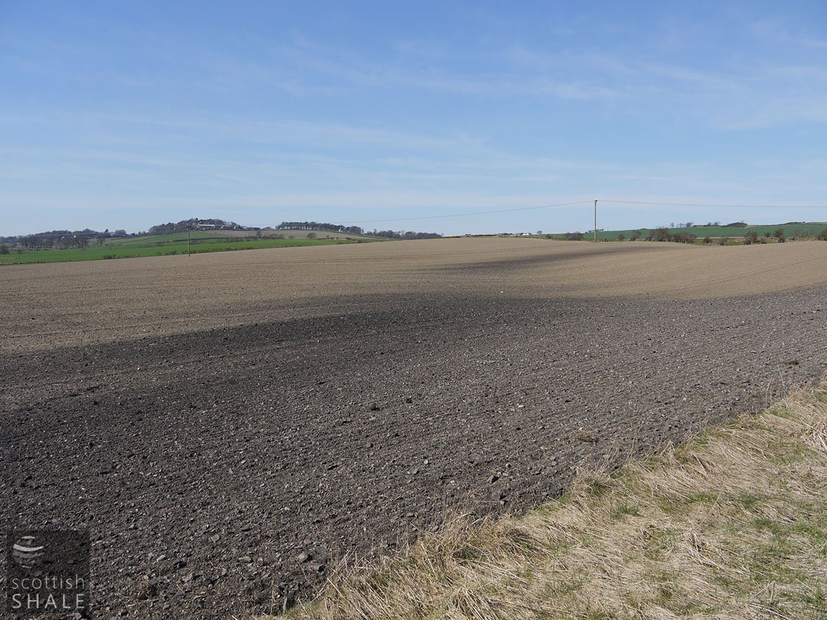
Telephoto view of the area of the pit. Looking north. April 2009.
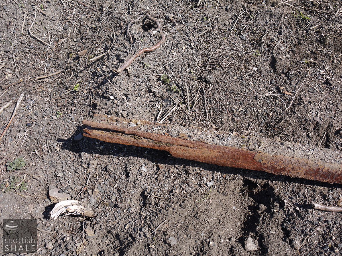
Some remnants of the branch railway that served the pit. April 2009.
- Coal Authority Mine Abandonment Catalogue No. 1870, showing workings in Broxburn Shale from Forkneuk No. 1, abandoned in 1886.
- Coal Authority Mine Abandonment Catalogue No. 5316, showing workings in Broxburn, and Upper Grey Shales from Forkneuk No. 1, 9, 10, & 38, abandoned in 1909.


