The Wood and the Rosebud
The remains of Armadale's early coal pits
F22021 - First Published 4th December 2022
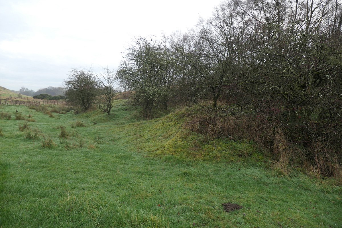
On a bright winter's day, with the sun low in the sky, deep shadows reveal every hump and hollow in the landscape. Journey along the footpath that follows the burn west from Barbauchlaw Mill (now the Mill garden centre), and you reach an area of irregular mounds and trackways formed by early industry. At about this point, the gentle valley of the burn narrows and deepens into the peaceful wooded Barbauchlaw glen. Beside the path that follows the southern lip of the glen, a grassy depression, a metre of so deep, marks the site of the Wood pit, the first substantial coal working in the Armadale area.
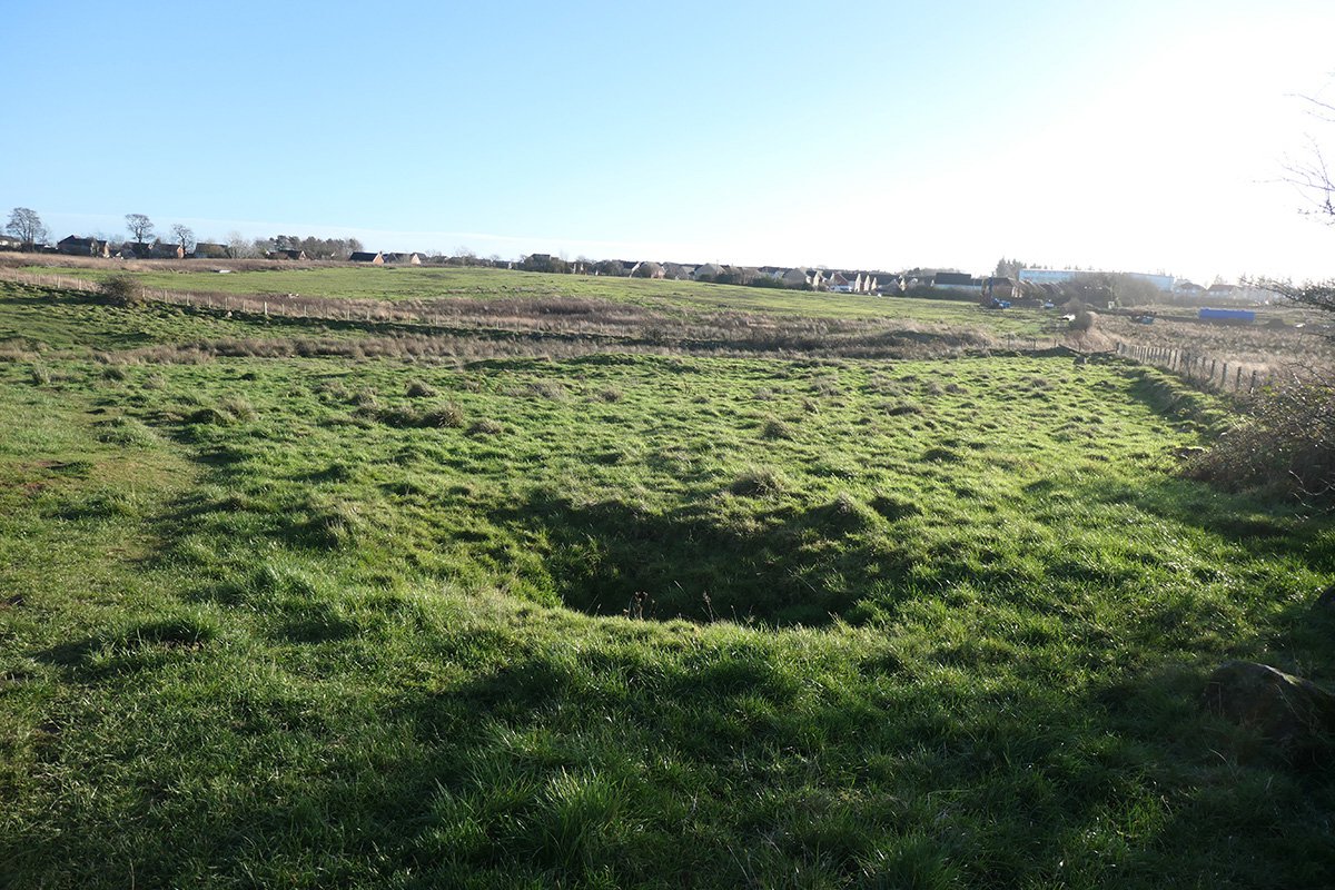
Shaft of the Wood pit.
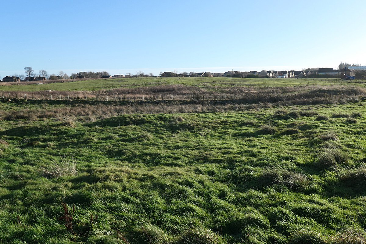
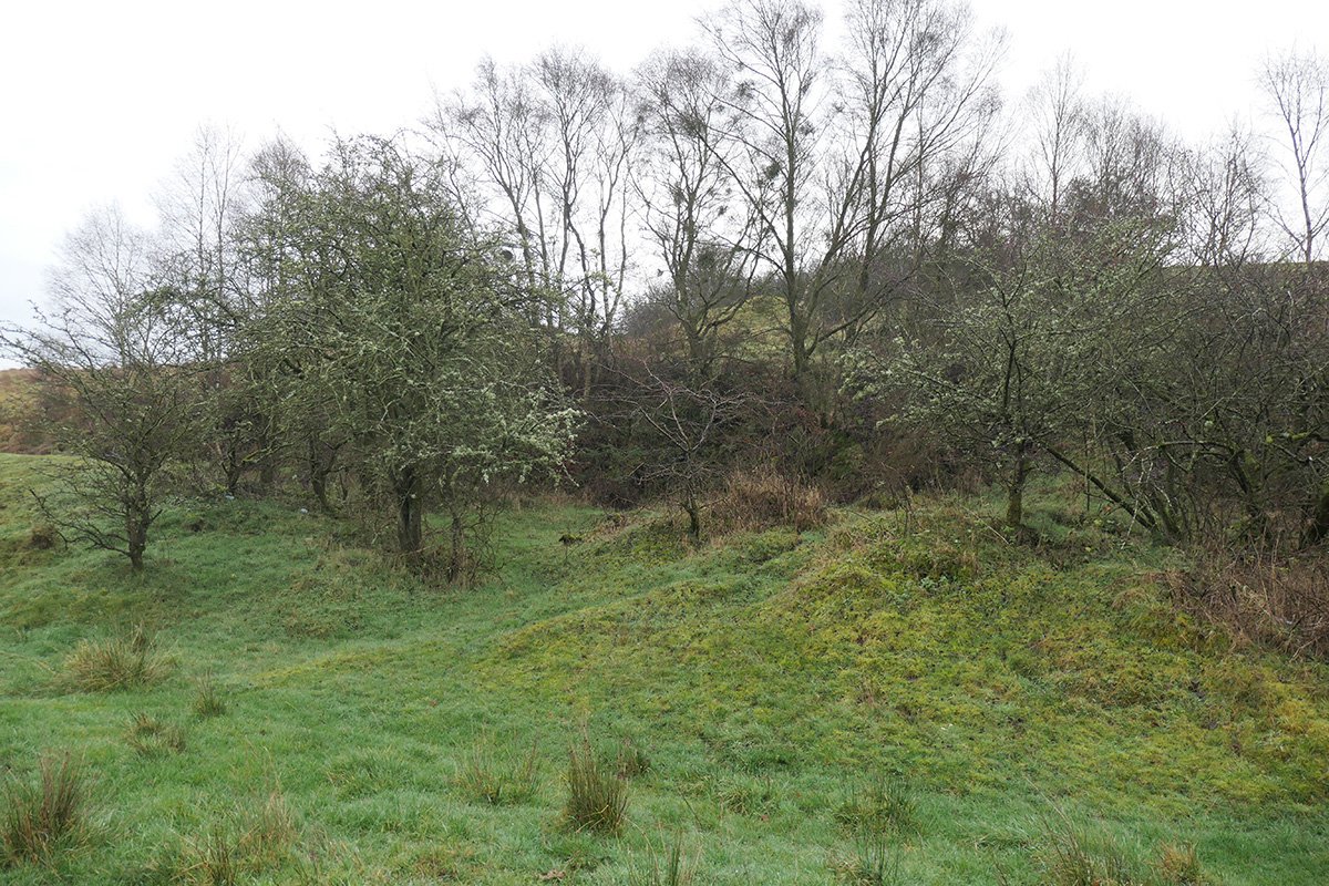
Site of the kiln at Wood pit, with suggestions of a buried rectangular structure
Much of what we know about these early coal workings is thanks to the enigmatic R Hynd-Brown who, in 1906, wrote a series of articles entitled “Armadale – Past and Present”. Hynd-Brown (perhaps this was a nom-de-plume?) seems to have had an encyclopedic first-hand knowledge of all things Armadale, stretching back to the dawn of the industrial age, when the town was no more than “a few red-tiled and straw-thatched, white-washed agricultural labourers' cottages”. Hynd-Brown tells of how, in about 1819, three local men formed the Boarbauchlaw Coal Company, which then sunk the Wood pit. He referred to the accounts of the company and provided interesting details of income, expenditure and men and women employed by the “Boarbauchlaw Coalrie”. Wood pit seems to have fallen derelict long before the first Ordnance Survey map in 1855, but the “old shaft” is clearly marked, and a nearby circular feature labelled “gin”. Here a horse harnessed to a lever would trudge on a circular path around a vertical shaft to turn the drum around which the haulage rope was wrapped. The rope passed over a wheel on a simple headframe to haul baskets of coal up the shaft. Hynd-Brown doesn't tell us the name of the gin-horse but informs us that it was supplied by William Brock of Barbauchlaw Mains farm at a cost of 13 shillings a week, An area of flat ground, perched on the very edge of the valley, still marks the site of the gin. The OS map also shows a track linking the pithead to the turnpike road, and a small rectangular structure marked “kiln”. The purpose of this is a bit of a mystery. Small quantities of ironstone would have been worked along with the coal and it was usual practice to process this by burning it in piles at the pithead. However it would seem most usual to construct a kiln for this purpose. A raised bank and hints of wall lines survive buried beneath the grass in this area.
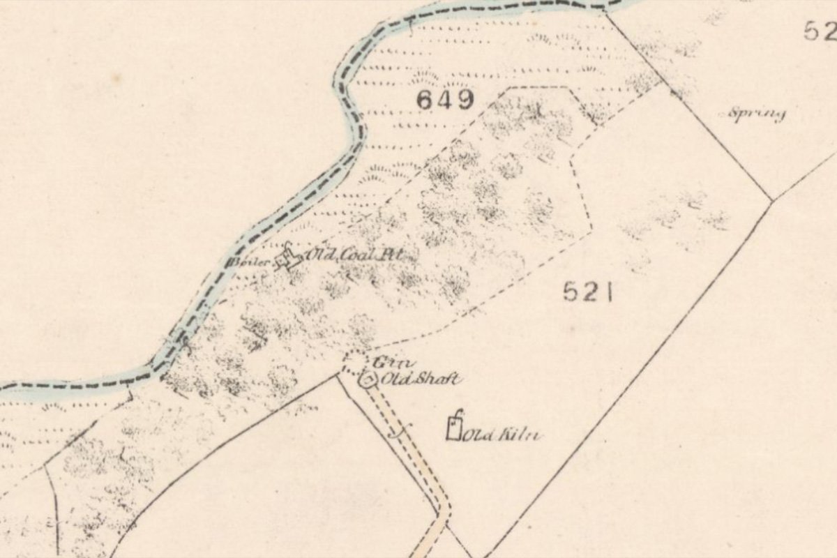
25" OS map c.1855 courtesy National Library of Scotland
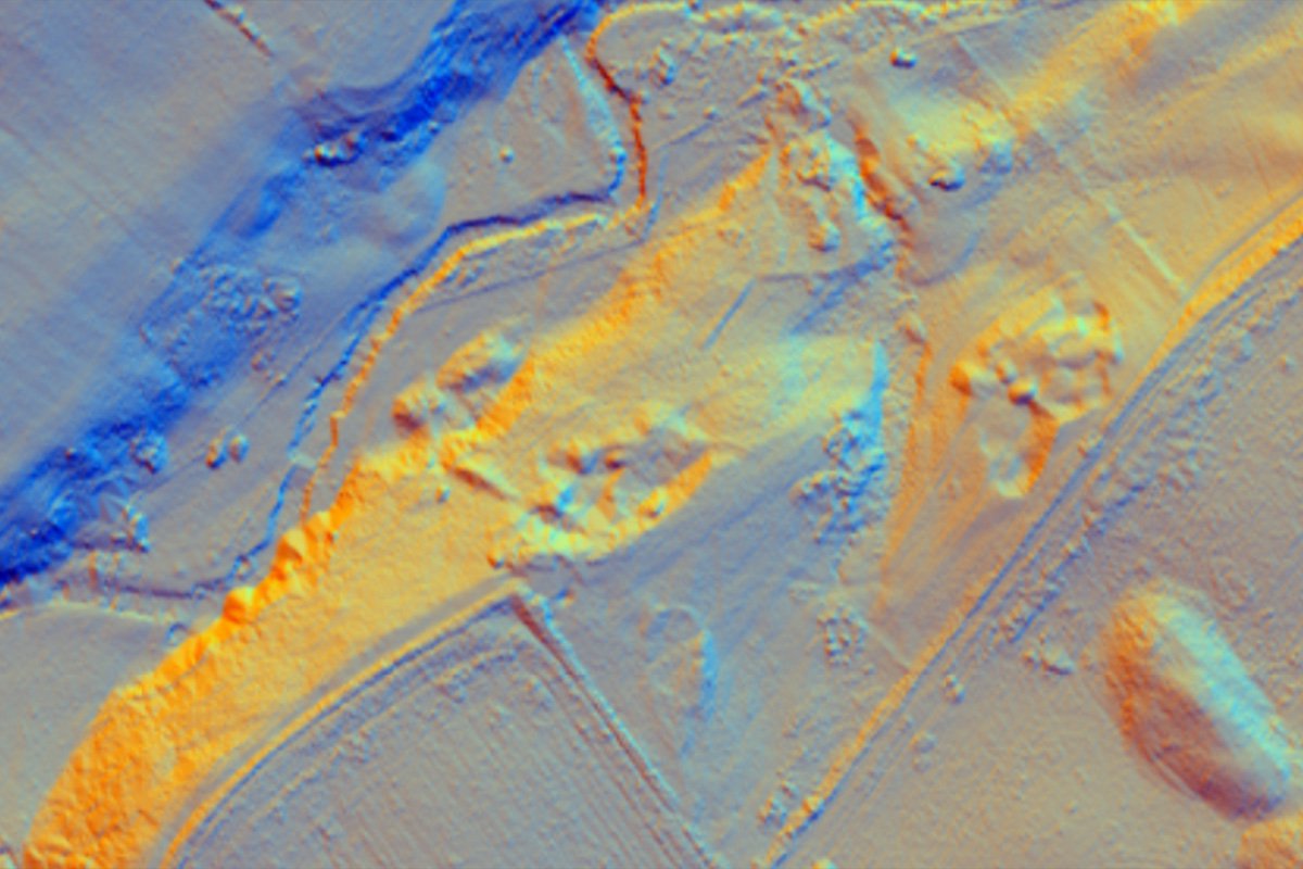
Lidar view
The 1850's map shows a further “old coal pit” and “boiler” down at the bottom of the valley on a little piece of haugh-land close to Barbauchlaw Burn. Hynd-Brown tells us that this is the site of the Rosebud pit, sunk in 1835, and the first in the area to use a steam engine. A little 10hp atmospheric engine was brought in to drain the shaft when the inflow of water became too much for hand pumps to cope with. The engine, which we are told was carted from Carluke, was also used to wind coal.
Rosebud pit was always at risk of flooding when the Barbauchlaw Burn ran high, and even in later years posed a threat to working pits that linked to the old workings. Hidden and forgotten in the quiet glen, two mounds still clearly mark the site of the engine-house and adjoining boiler. There are various mounds and cuttings on the steep valley side between the Rosebud pit and the Wood pit. Here, and further to the east, there is evidence of later excavations, perhaps unofficial workings during the miners strikes of the 1920's? Despite this later disruption, aerial radar images hint at a steep incline running up from the valley bottom to the top; perhaps the route by which coal was hauled , by a patient gin-horse.
Given the huge transformation that Armadale has witnessed over the last two centuries, it is remarkable that these remains of early industry has survived, and it is tantalising to imagine what over evidence might survive beneath the soil.
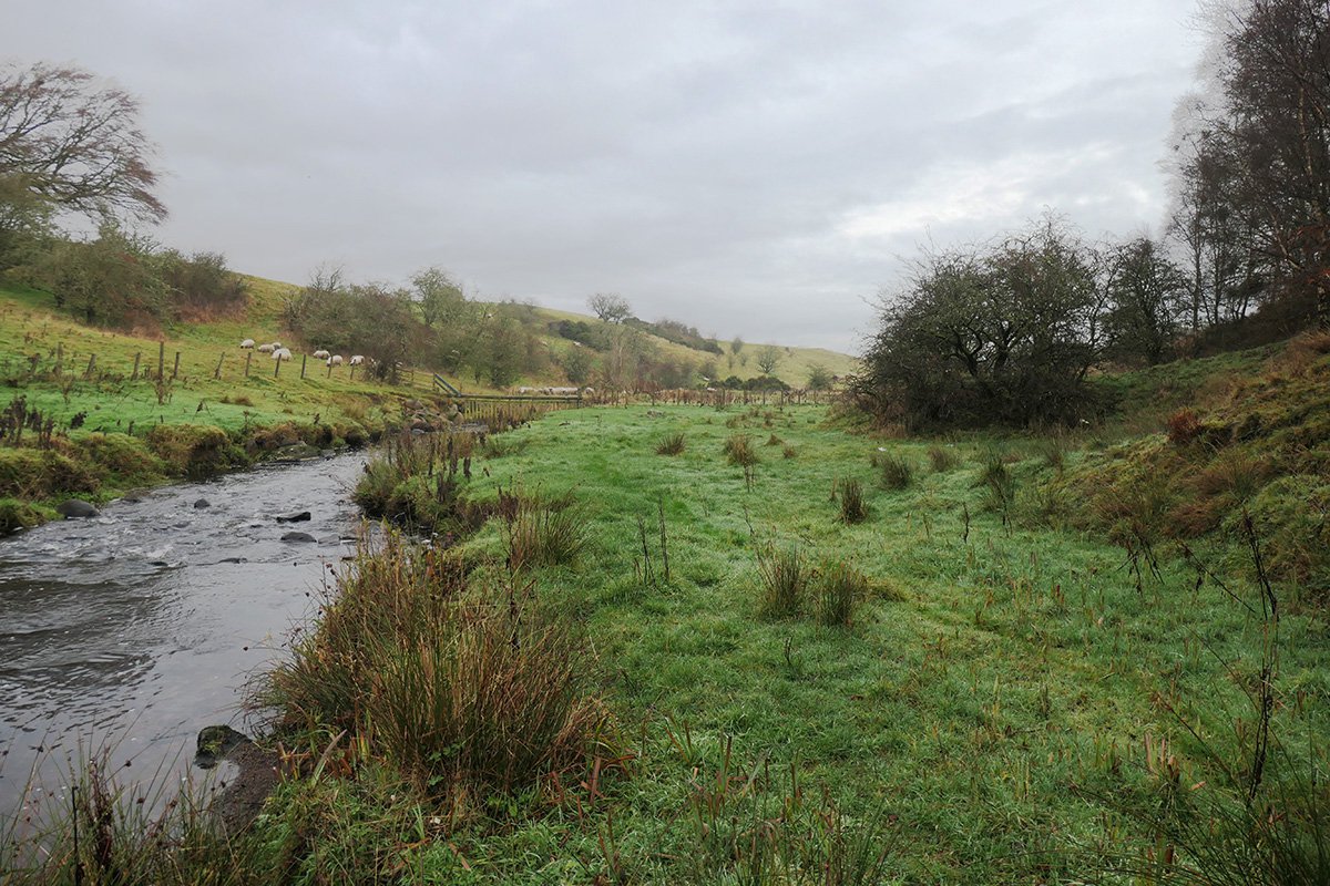
Barbauchlaw burn with clump of trees marking the site of Rosebud pit
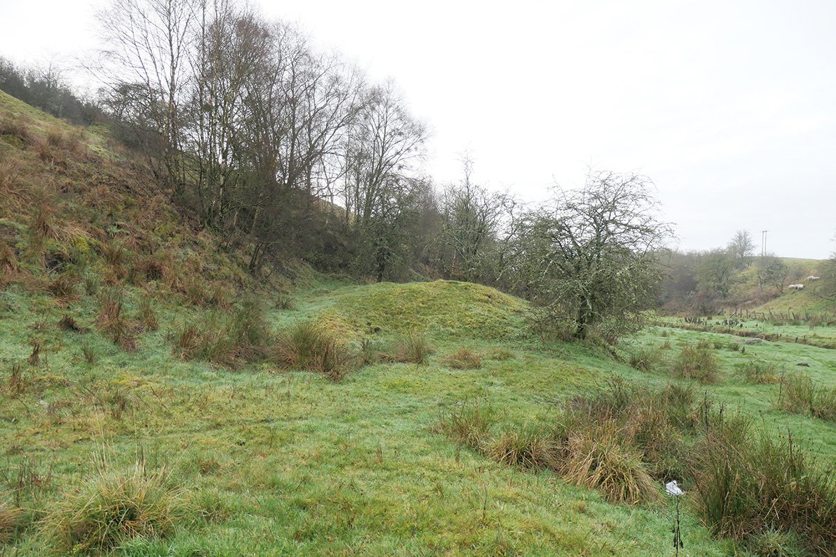
Site of Rosebud pit
Site of Rosebud pit
Site of Rosebud pit