The Mysteries of Muirhall
Muirhall and its curling green
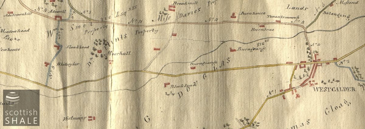
“Moorhall” and surrounding trees from an “Eye draught of cross roads in the parish of West Calder” 1808, prior to construction of the current A71 between Blackbrae and Breich.
F19008, first published 10th February 2019
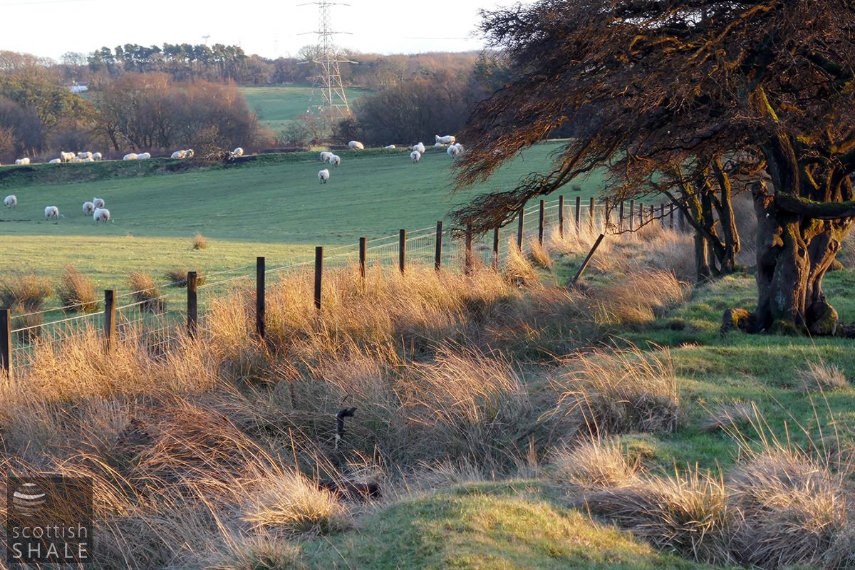
Travelling along the A71 from West Calder towards Briech, just before reaching the Muirhall whisky warehouses, there’s an unremarkable stretch of boggy ground between the road and railway inhabited by a few happy sheep.
At one time the skyline to the north would have been dominated by the mighty Addiewell oil works, and you might imagine that the traces of banks and boundaries that cross the boggy field result from industrial activities. While the field certainly bears the scars of mines and mineral railways, there remains a rectangular pattern of low banks within the waterlogged beds of rushes that seem to have a much earlier origin.
There is apparently mention of Muirhall in family papers dating from 1552, which was recorded as the home of the Flint family. A wonderful hand-drawn map in our collection, dating from 1808, shows “Moorhall” as a simple rectangle surrounded by trees and labelled “Dr. Flint’s property”. Other early maps (the first being Roy’s map of c.1755) provide a more detailed impression of buildings at Muirhall set within a grid of tree-lined enclosures. These suggest a residence of some importance rather than just a humble farmhouse
Curling pond banks at the rear of Beechwood cottage, with Briech villa in the distance.
Curling pond banks at the rear of Beechwood cottage.
Curling pond banks at the rear of Beechwood cottage.
Curling pond banks at the rear of Beechwood cottage showing remains of a sluice mechanism controlling flow of water out of the pond.
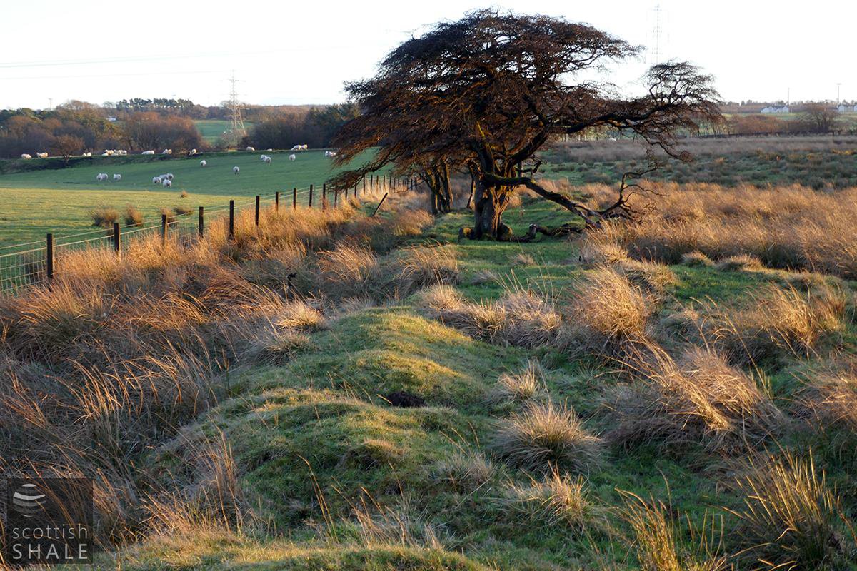
Sheep rest on the low embankment of the mineral railway which served the Muirhall pits until the 1880's.
When the turnpike road from West Calder to Briech, and onward to Ayr (the current A71) was constructed in the 1820’s, it appears that a new farmhouse was built facing onto the new road. The first Ordnance Survey map, surveyed in about 1852 shows the original Muirhall house still set within its leafy paddocks, but without any name or label attached. Circumstances are explained in the associated OS name book which describes Muirhall as “a small farm house and offices in good repair with garden and about 70 acres of arable land attached, occupied by George Stewart, the property of Andrew Mungle”, then adds “a short distance from this house are the ruins of the old farm house of Muirhall.”
This rural area was to change fundamentally when work began on construction of mighty Addiewell oil works, late in 1864. Within four years, the Caledonian Railway was progressing with construction of their Midcalder and Cleland line to serve the new shale districts, cutting across the lands of Muirhall and clearing the lines of trees that formed enclosures to the north of the old farmhouse. A plan dated 1869 (from our BP collection), shows that much of the old farmhouse site, and the wooded enclosures to the south, survived this trauma.
James Young secured the mineral rights for the lands of Muirhall in 1867, and within a few years his company had purchased Muirhall and Easter Whitesykes. Pits were sunk in the area but had a disappointingly short working life. Muirhall no.16 & 19 to the Hurlet coal were closed in 1877, and a shale pit, Muirhall No.18, was abandoned in 1878. Much of the route of the mineral railway constructed to link these pits to Addiewell works is still clearly evident.
In about 1880, Young’s oil company formed a road along the southern side of the Caledonian Railway and constructed three solid villas. Beechwood and Elm cottages, and their outhouses, were build on the site of the original Muirhall house, while Hawthorn cottage lies a little to the west. Through the years these were home to various senior oil company officials including assistant works managers, a chief cashier and a head chemist.
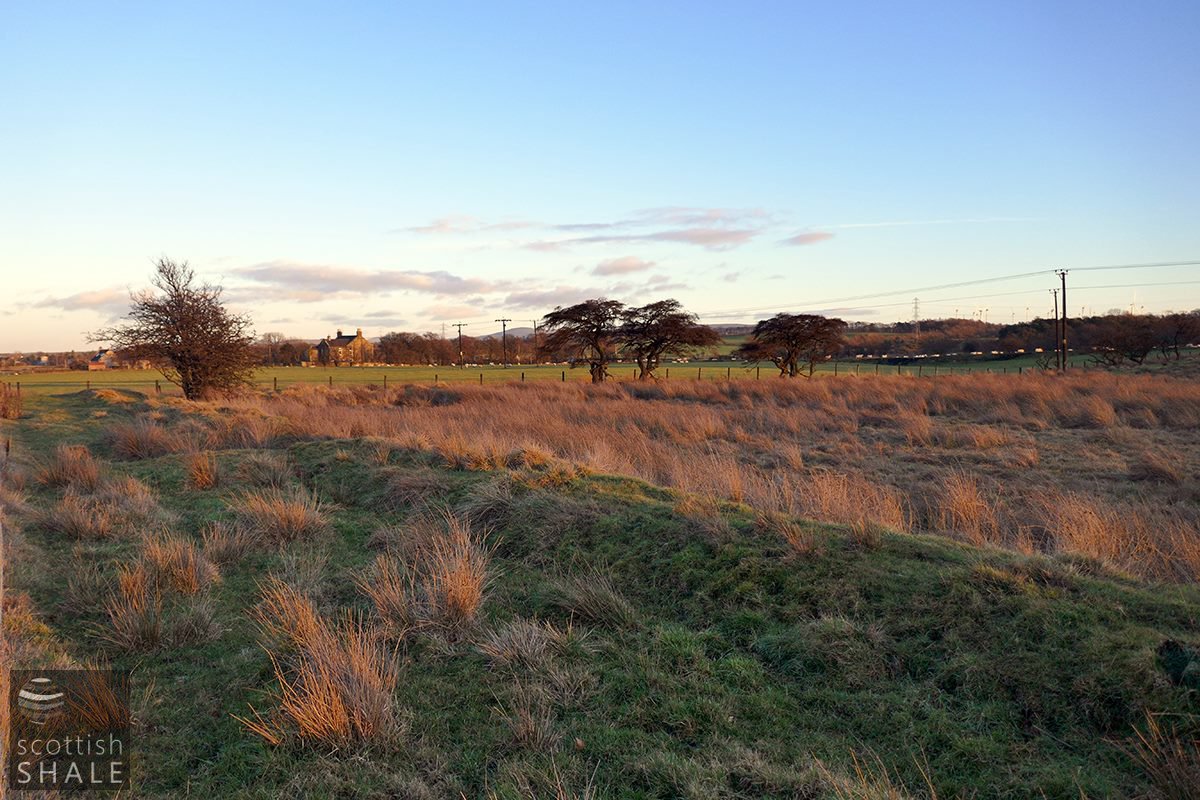
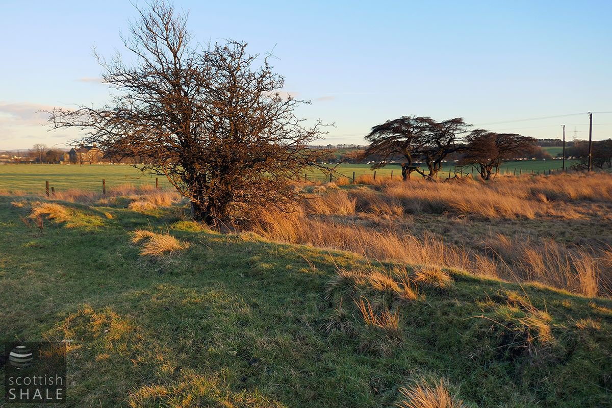
The land at the back of the houses, once good arable ground, became progressively waterlogged, probably as a consequence of mining subsidence. The rectangular boundaries of the old farm survived however, and, at the start of the 20th century, part of these were reinforced when banks were raised to create a curling pond.
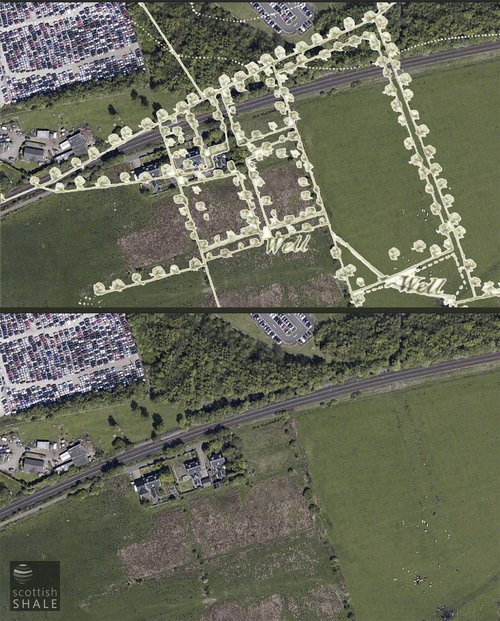
The oil company villas passed into private ownership in the mid-20th century, by which time the curling pond had become abandoned. On the ground it is now difficult to make sense of the low banks and stunted hedgerows within this waterlogged area, however when viewed from the air it is remarkable how these coincide with layout of the old Muirhall, and might date back more than 300 years.
Above right: Detail from the 1852 6”OS map (courtesy National Library of Scotland) overlaid on a recent aerial view.
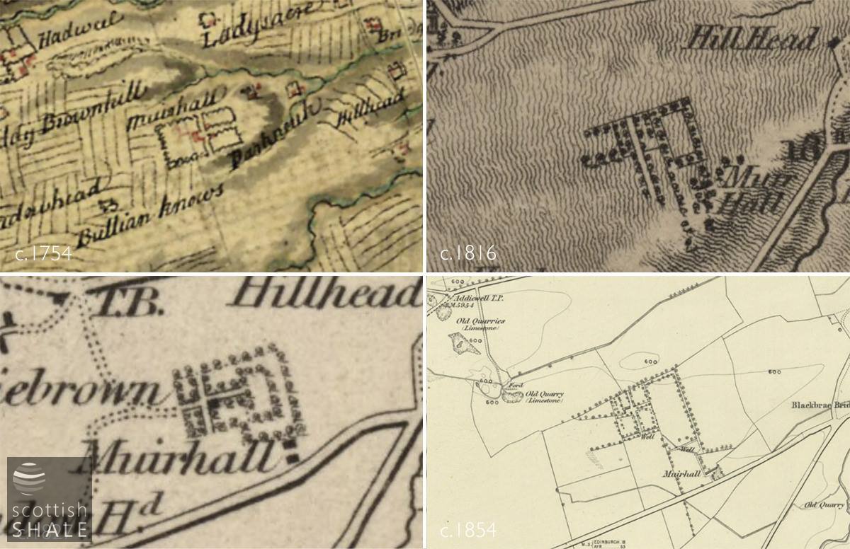
The wooded enclosures of Muirhall – as shown on early maps – all courtesy of National Library of Scotland.
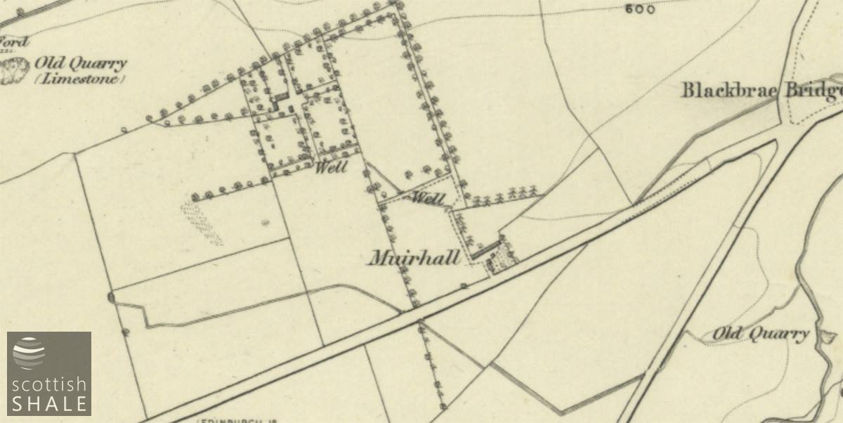
6” OS map, surveyed 1852 courtesy of National Library of Scotland.
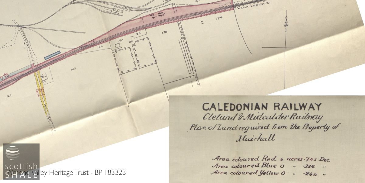
Property plan – redrafted from a survey of 1869, and realigned to fit.
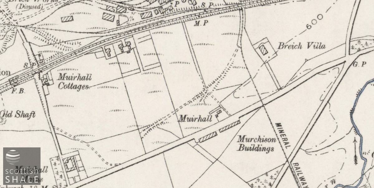
6” OS map, Linlithgowshire revised 1895 courtesy of National Library of Scotland, shows the area as boggy ground. – interestingly, the 1893 6” OS map of Edinburghshire map shows lines of trees along the field boundaries.
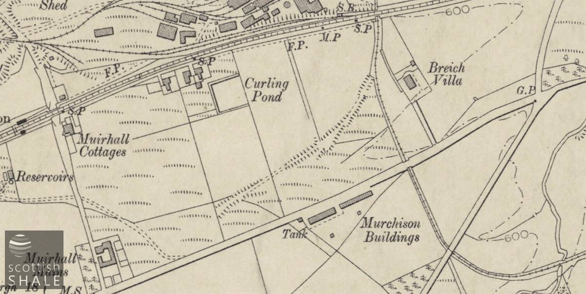
6” OS map, Edinburghshire, revised 1905 shows a curling pond now in place, courtesy of National Library of Scotland.
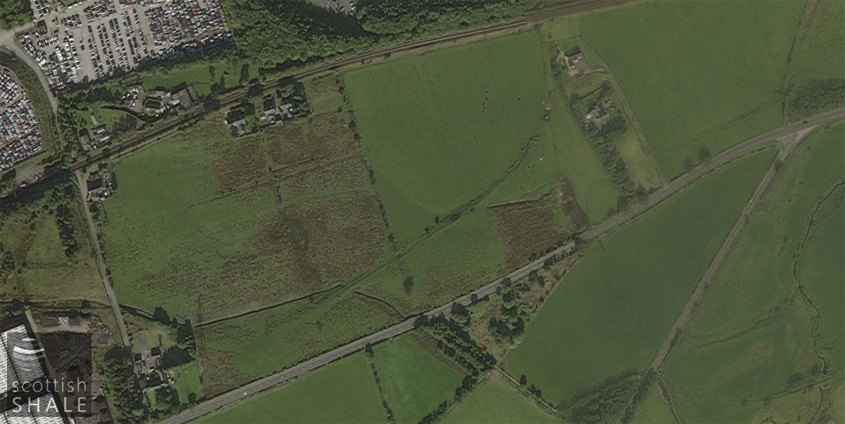
Recent aerial view.

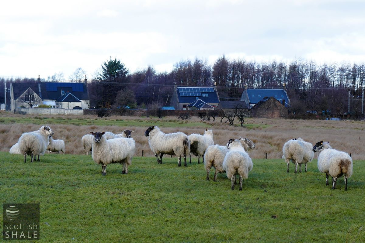
Telephoto view on a grey day with (from left to right), Hawthorn, Elm and Beechwood cottages, and beyond them the Midcalder and Cleland Railway and the site of Addiewell oil works. Between the flock and cottages, a stunted hedgeline and low banks survive as remnants of the early Muirhall.
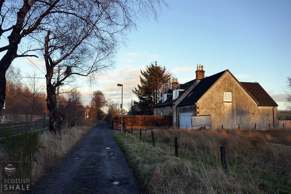
Twilight view looking east towards Hawthorn cottage, with Elm and Beechwood cottages beyond.
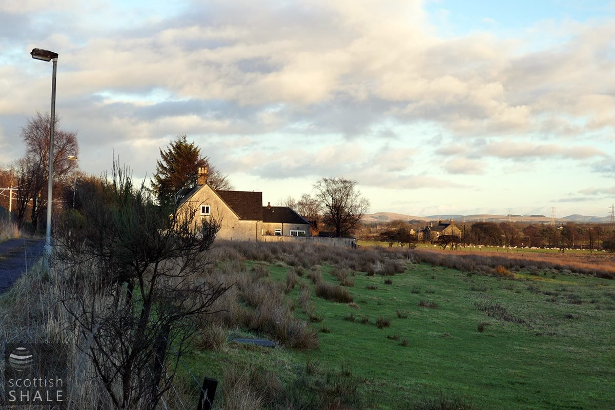
View showing boggy ground at the rear of Hawthorn cottage, with Breich Villa (and the Pentlands) in the distance.