Happy Homes Hidden within Woodmuir Forest
Evidence of an early coal mining community
F23002 - first published 21st January 2023
During the1780’s a new turnpike road was built, linking Edinburgh with the burgh of Lanark. The great toll road passed though Mid Calder and West Calder before striking out on a new route, gradually climbing by way of Longford, and crossing the high moors of Woodmuir. Here it met the new Cleuch Road (which linked Wilsontown Ironworks with the port of Bo’ness), and continued southwards into Lanarkshire. Much of the route through Woodmuir ran parallel to the Skolie or Longford Burn. The underlying strata would have been exposed in the bed and banks of the little burn, and seams of coal were probably revealed within easy distance of the new road.
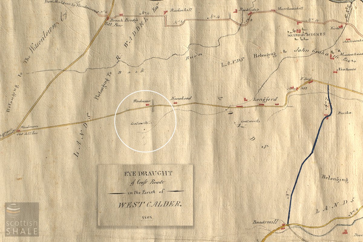
See full record LVSAV2017.041, 1808
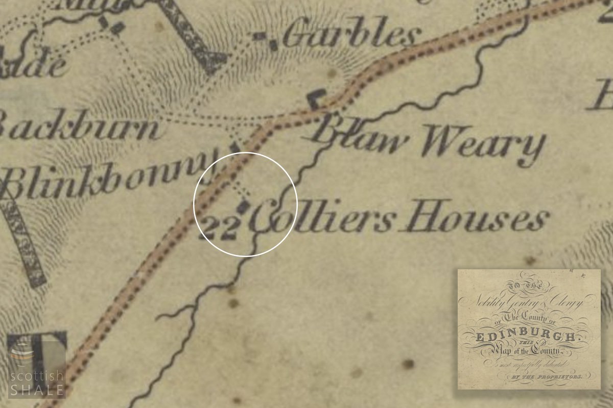
Sharp, Greenwood and Fowler's map of the Lothians 1828, courtesy National Library of Scotland
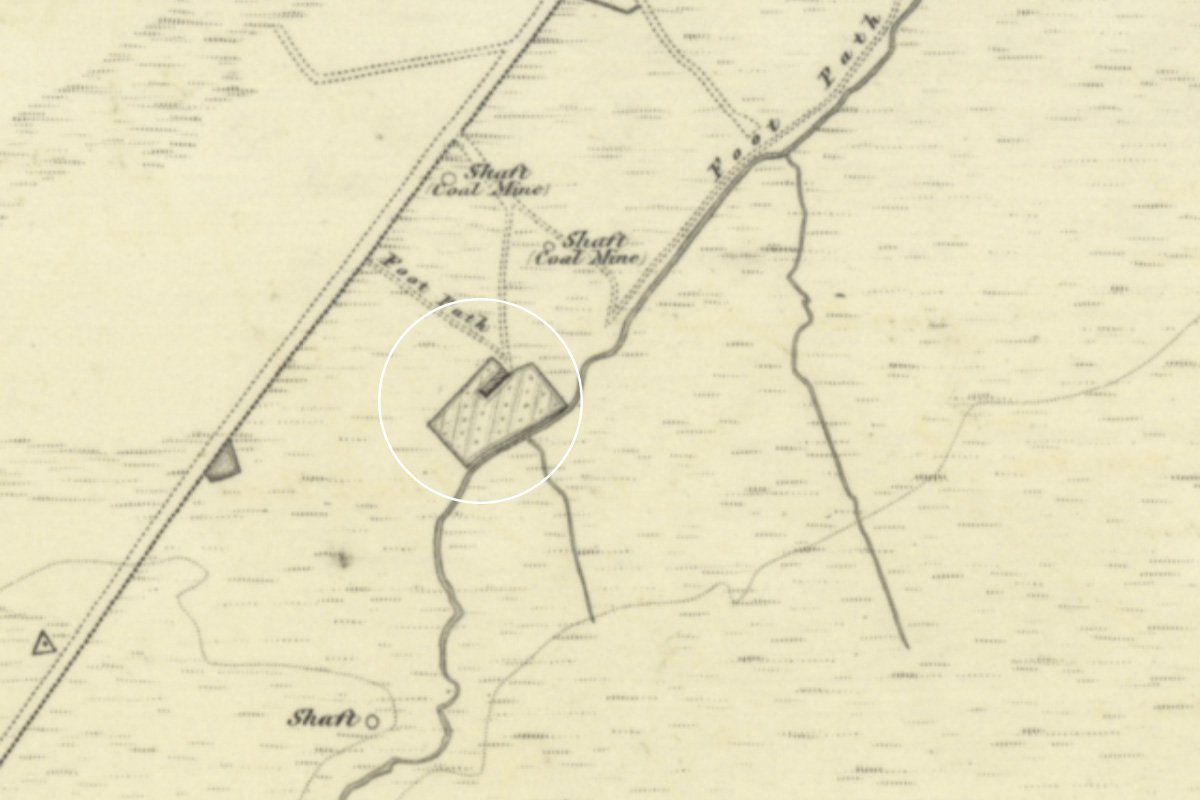
6" OS map c.1852, Courtesy National Library of Scotland
A hand drawn map in our collection, dated 1808, is perhaps the earliest to show coal workings at Woodmuir; with two tiny circles perhaps representing shafts, and a slightly bigger dot close to the Skolie Burn perhaps indicating a building. On Sharp’s map of the Lothians, published in 1828, the site of this little dot is boldly marked as “Colliers Houses”, and the first edition OS map, surveyed in 1852, shows these houses as a neat row of cottages, set within a garden, and overlooking the burn. Two shafts, marked “coal mine” are nearby and linked to the road by footpaths. Notes made at time by the Ordnance Survey record that ten men were then employed in the Woodmuir colliery, producing about 14 tons each day. It appears however that the pits nearest to the cottages were already exhausted by that time, and mining was then focused further upstream. Over a dozen small pits, either side of the Skolie burn can be identified from old maps or from depressions that remain in the land surface. These would have been shallow pits, draining naturally into the burn, with coal wound to the surface using a horse gin of a person-powered windlass. Most of these small workings were abandoned by the end of the1860’s when two much larger and deeper pits were sunk to the north of the turnpike road.
The little row of four “colliers houses”, set in gardens overlooking the Skolie Burn, are named “Burn Row” on later maps, but are referred to elsewhere simply as the Burnhouses. The 1851 census tells us they were home to William and Janet Lind and their four children, also David and Elizabeth Mackie and their three children, David Muir, a widower with two daughters, and Robert and Elizabeth Wood and their baby son. Most other members of this little mining community lived in a row of four cottages, a short distance away, close to the turnpike road. This place was known as Blinkbonny, presumably because its elevated position provided a lovely view eastwards towards Edinburgh.
Blinkbonny was perhaps a truck-stop of its time; a refuge on a lonely stretch of highway where emergency repairs might be carried out to horses, carts, and carriages, and where you might get something to eat and drink. In 1851 these operations were under the charge of William Wyper, described as a blacksmith, grocer and spirit merchant, and his wife Mary, who kept the shop. On the night of the 1851 census, this little cluster of buildings – described elsewhere as occupied “by miners and people of the labouring classes” - was home to 34 people. This including several coal and ironstone miners recorded as “visitors”; – presumable part of an itinerant workforce common in mining districts. Blinkbonny will have been a lively place.
Tragedy stuck both communities in 1859. William Thornton, a resident of the Burnhouses, was working alone digging a new shaft for a coal pit. When this hole in the ground reached a depth of 36 feet he encountered a pocket of foul air that rendered him unconscious. Thomas Girdwood, who lived in Blinkbonny, happened to be passing and climbed down to rescue William, but was also overcome. Both men suffocated. The 1861 census shows William’s widow Jane, and her four young children, were then still living at Burnhouses.
The little settlement of Blinkbonny was to grow substantially to house the workforce of new industrial-scale collieries at Woodmuir. After a long decline, the village of about 31 homes was finally cleared immediately prior to the second world war, and the site is now a convenient car park from where you can enjoy the beautiful view
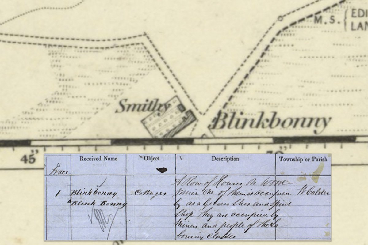
6" OS map and OS Name Book c.1852, courtesy National Library of Scotland
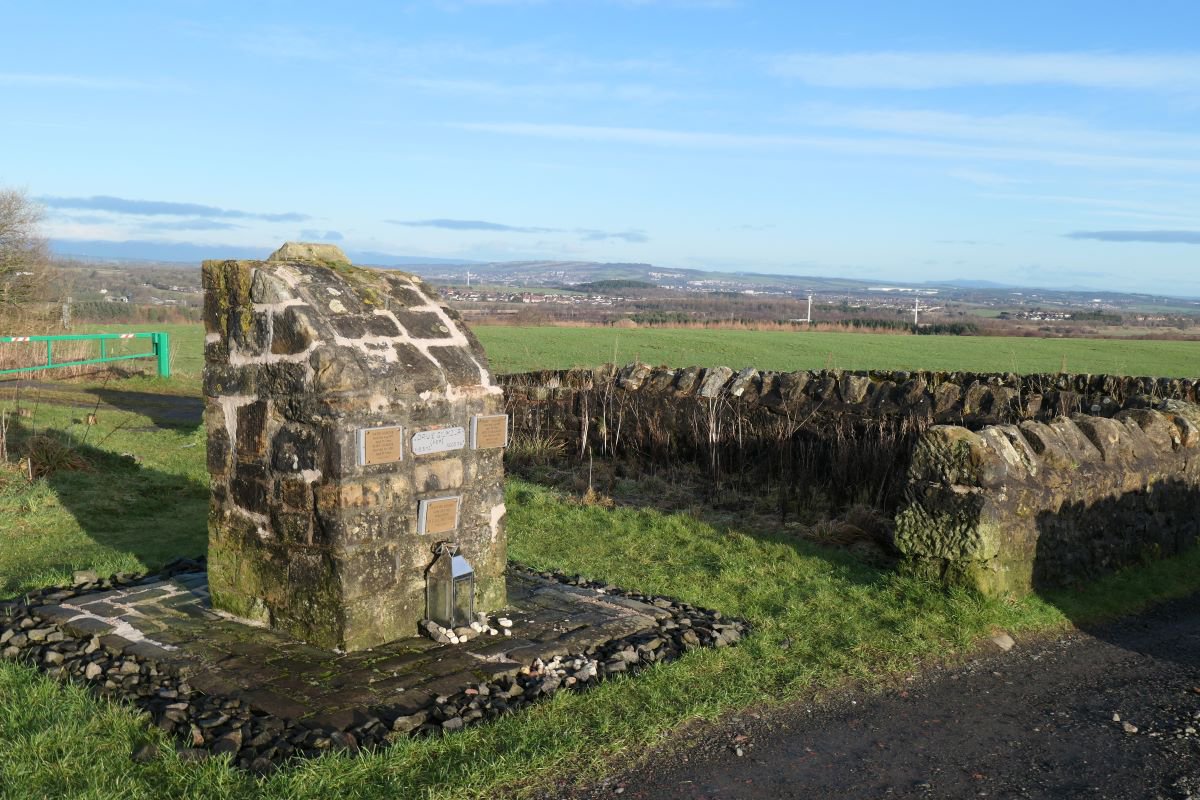
Site of Blinkbonny, and a lovely view.
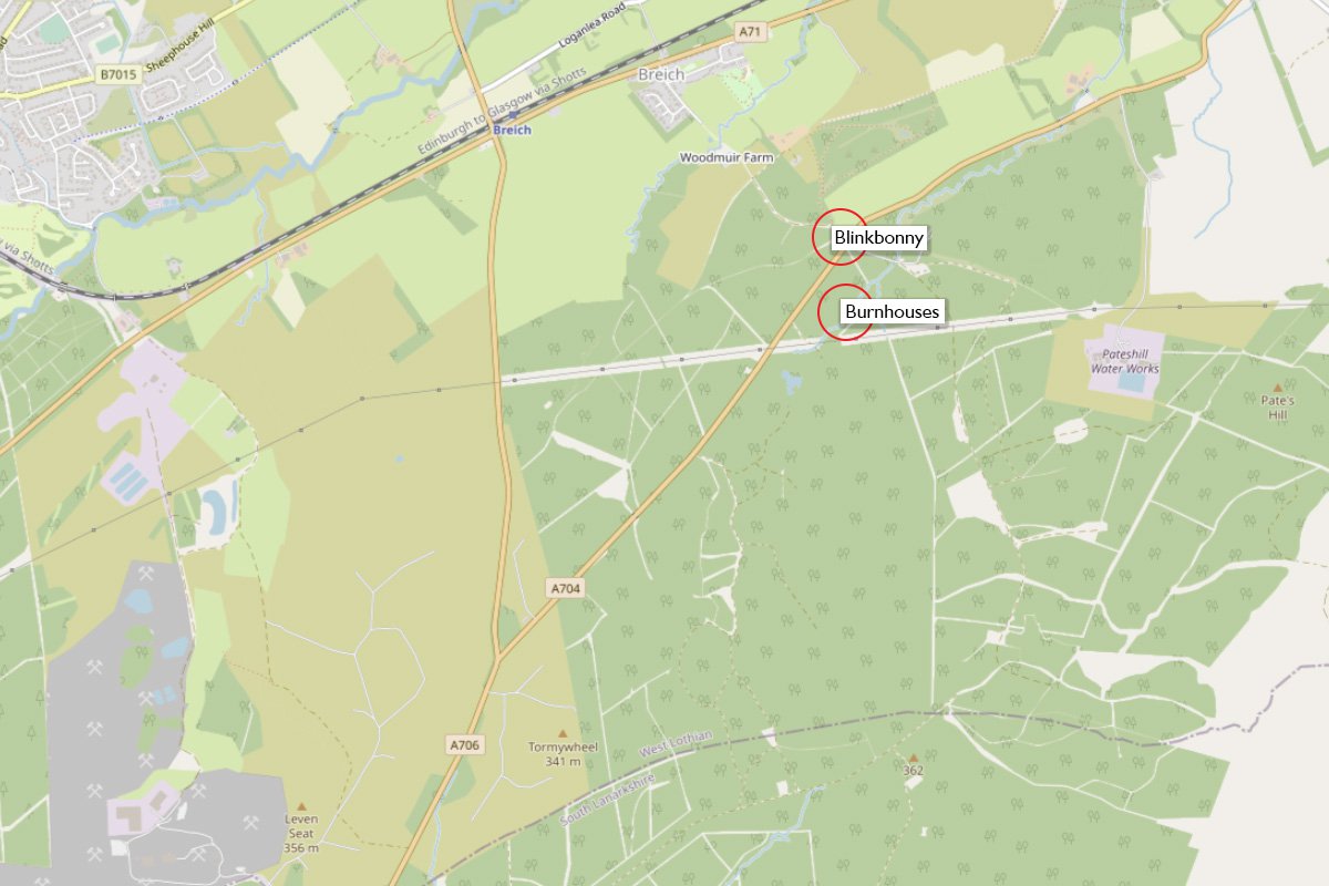
Locations
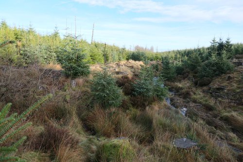
The little row at Burnhouses was abandoned in about 1900, and allowed to slowly decay within a mossy landscape peppered by the humps and hollows created by the early miners.
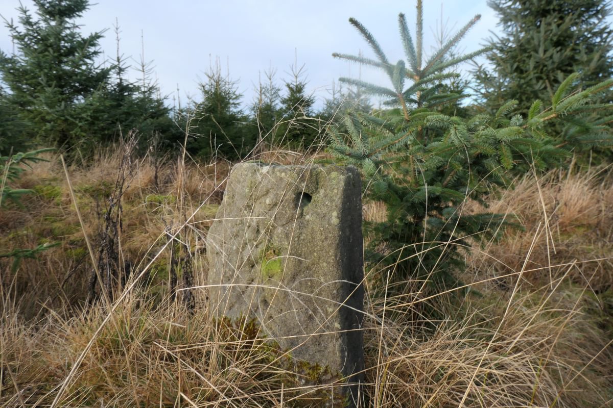
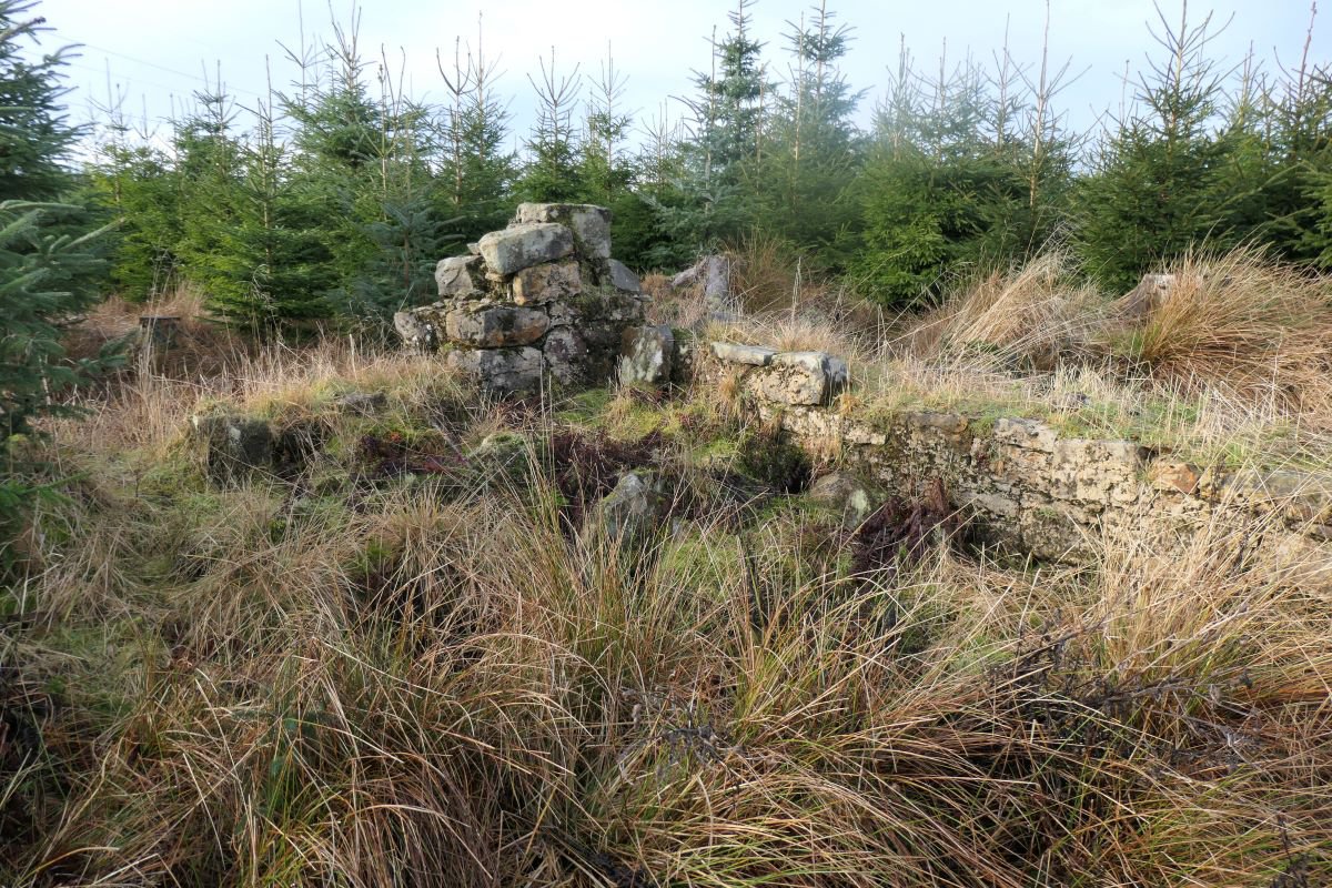
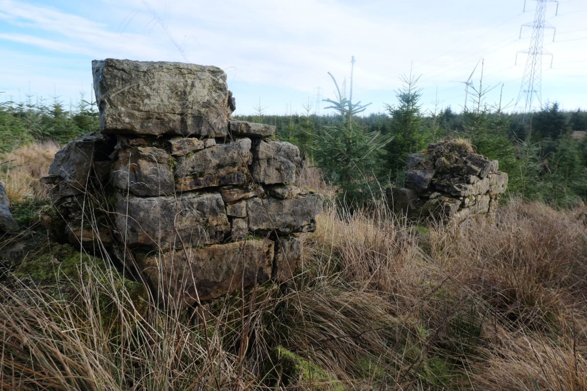
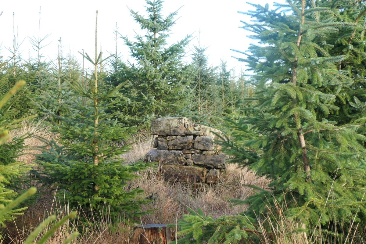
This scene changed fundamentally at the end of last century when uplands for miles around were planted with coniferous trees to establish the Woodmuir Forest. The first crop from this commercial forestry was felled about a decade ago, but a new generation of conifers are already cloaking the lands around the Skolie burn. It is difficult to push your way through the intermeshing branches of this green wall of Christmas trees, and the deep furrows beneath your feet further hinder progress. It’s really easy to lose your way within this featureless maze, but with a little planning, determination, and luck, you can find your way to a little clearing in the forest that was once the site of the Burnhouses. It’s over 120 years since anyone called this place home, but many of the external walls still stand to waist height, and the internal walls that divided this space into four single-room homes at still evident. Standing slabs of stone make the hearths that would kept off the winter chills.
The life of an early coal miner would have been hard one, yet these little cottages, with a fine view south across the burn and surrounded by gardens, would have been a pleasant spot to live and raise a family.
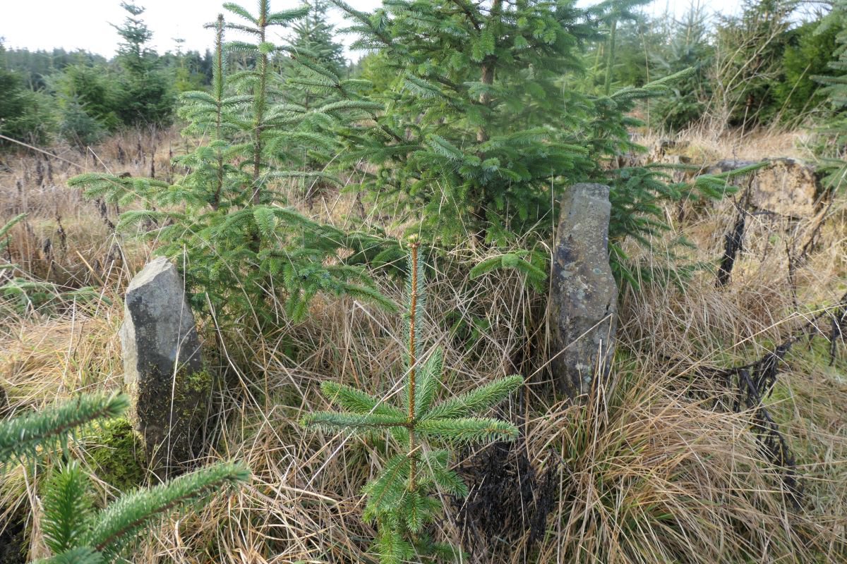
Burnhouses, 15th January 2023
Burnhouses, 15th January 2023
Burnhouses, 15th January 2023
Burnhouses, 15th January 2023
Burnhouses, 15th January 2023